A desk with a keyboard, headphones, video game controller, toy and candy on it. On top of the photo text reads: Geoscience Today: Geoscience and Video Games.

Geoscience and Video Games

What do geoscience and video games have in common? More than you might think. Geoscience is key to understanding our world and addressing environmental crises. Despite this, geoscience programs continue to see a decline in numbers, and getting youth excited by and interested in geoscience is vital to the continuation of the field.  In Canada, youth spend an average of 7.9 hours per week playing video games. Video games are designed to entertain and often provide immediate rewards. In her 2010 TedTalk “Gaming can make a better world,” Jane McGonigal argues that self-learning from video games is just as important as formal education. By the time the average person in a country with a strong gaming culture turns 21, they will have spent 10,000 hours playing video games (Carnegie Mellon University). That same youth will have spent 10,080 hours in school from grade 5-12. “We have an entire parallel track of education going on, where young people are learning as much about what it takes to be a good gamer as they’re learning about everything else,” Jane states.  When gaming, youth are developing skills, adapting to changing environments, problem solving, and taking in new information. Judy Willis (2007) states that, “when students are engaged and motivated and feel minimal stress, information flows freely through the affective filter in the amygdala and they achieve higher levels of cognition, make connections, and experience “aha” moments. Such learning comes not from quiet classrooms and directed lectures, but from classrooms with an atmosphere of exuberant discovery.” I would argue that this theory applies not just in the classroom, but in informal settings including while youth are playing video games. Research shows that there are two main types of self-learning: tangential learning and incidental learning. Tangential learning is when someone consciously educates themselves on a topic they have been exposed to and in which they have interest. Incidental learning is less conscious and occurs through engaging in activities and tasks that promote learning. Video games are good at both of these types of self-learning. So, youth are learning from video games, but what exactly are they learning? There are two main types of video games: educational and entertainment. Educational, also called serious, games are designed with education as a priority. Often, these types of games sacrifice entertainment and end up being somewhat less engaging than off-the-shelf games. Popular off-the-shelf games usually use larger-than-life experiences or fantastical and magical environments to entertain players. As far as science communication is concerned, both educational and entertainment-focused games have the potential to teach science. However, it has been found that youth playing educational games tend to get bored easily and lose focus, which undermines some of their effectiveness (E. G. McGowan and J. P. Scarlett, 2021).  McGowan and Scarlett (2021) looked at the representation of volcanoes in off-the-shelf, or entertainment-focused, video games. They analyzed 11 of the most popular video games that contain elements of volcanism. They looked at what types of volcanic hazards were represented and whether or not they were scientifically accurate.  They chose to study volcanoes because they are a common geological phenomena that are often used in video games either as part of the background landscape or to provide a dangerous challenge. Volcanoes in real life can of course produce fascinating and beautiful landscapes as well as deadly effects such as lava flows, toxic ash fall, volcanic gases, lahars, pyroclastic flows, lava bombs, and more. This makes volcanoes a good challenge for players and is why they are often included in video games. The researchers wanted to find out if volcanoes were being portrayed with scientific accuracy. They found that the video games studied all had both accurate and inaccurate features of volcanoes, with no single video game being completely inaccurate or completely accurate. This means that any video game will have some aspect that correctly represents volcanoes, and so can inform gamers via incidental or tangential learning. It also means that any video game will have some aspect that may mislead or incorrectly teach people who play them. However, since most of these inaccuracies are used for the purpose of dramatization, it’s not necessarily the case that people are mis-learning from them. After all, people are capable of distinguishing video game landscapes from real ones.  A study by Hut et al. (2019) compared how well geoscientists and non-geoscientists could determine which landscapes in a video game were accurate to reality. They found that while geoscientists could more accurately determine false from real landscapes, non-geoscientists were also able to determine the difference fairly well. They concluded that despite the minor difference, video games can still be used for tangential learning on geoscience subjects.  McGowan and Scarlett (2021) concluded that video games could be used for outreach purposes in order to spark interest and get people invested in geological phenomena that they might not otherwise be interested in. This can lead to incidental and tangential learning, since video games are engaging and exciting. Once people are interested in a topic, they are more likely to seek out more information themselves and put effort into learning, so this can lead to more geoscience education. We can use video games for geoscience education, but we also need gamers for the field of geoscience. In her TedTalk, Jane McGonigal argues that gamers are learning four things while playing video games: urgent optimism, social fabric, blissful productivity, and epic meaning. Firstly, urgent optimism is the ability to act immediately to achieve a goal, with the belief that it is possible to complete. Secondly, gamers weave a tight social fabric through collaboration and competition with others. Next, gamers are experiencing blissful productivity. Video gaming is often associated negatively with laziness or lack of motivation, when in reality, gaming is productive work. It’s work that often feels more immediately rewarding than real-life work due to instant in-game rewards. Finally, epic meaning is the belief you are completing something meaningful and awe-inspiring, even if just to a fictional world.  Chris Skinner (2021),
Read More »
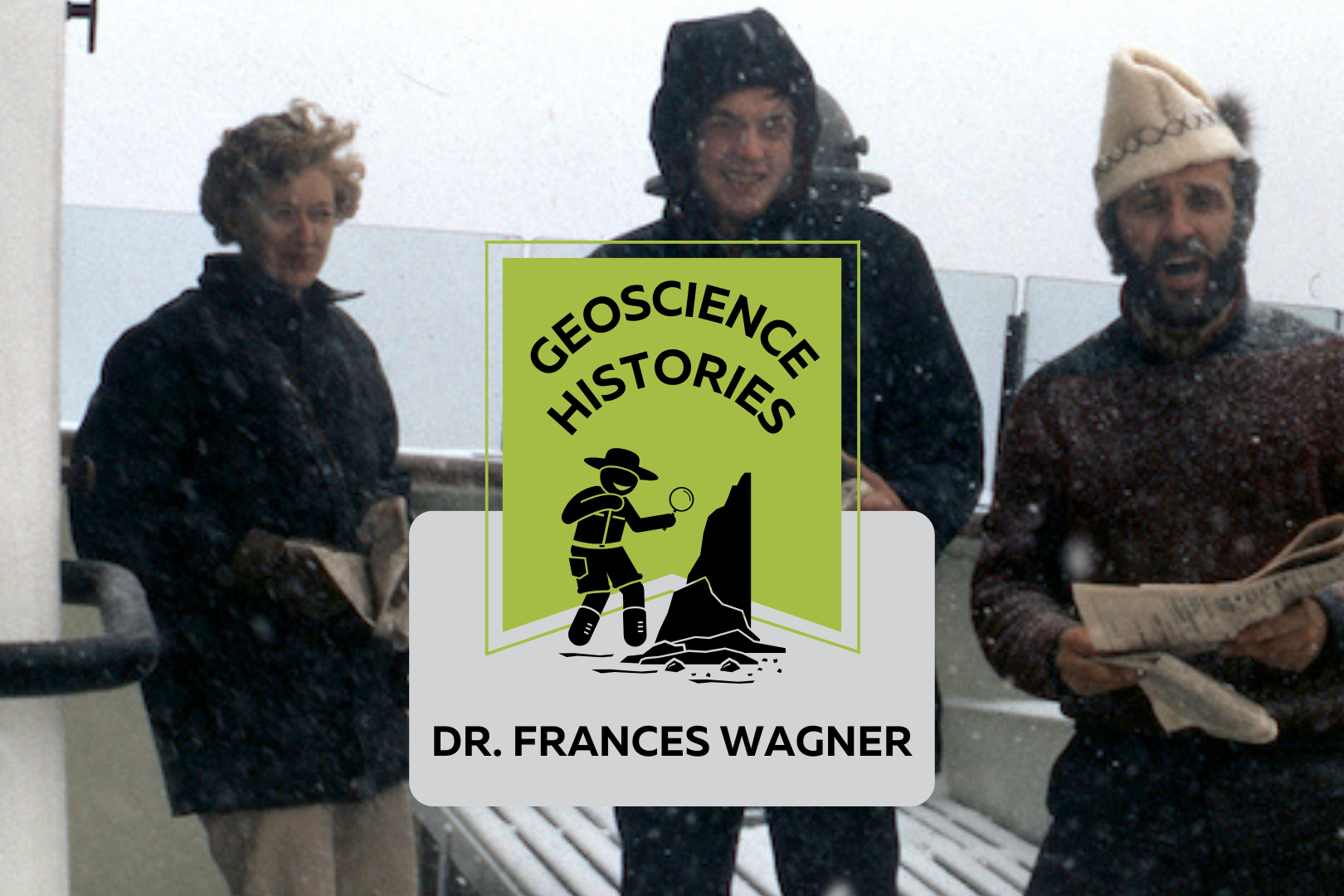
Three people standing on the deck of a boat with snow falling. Text on top of the photo reads: "Geoscience Histories, Frances Wagner"

Geoscience Histories: Dr. Frances Wagner

Frances Wagner was one of Canada’s first female geologists. Her studies in micropaleontology and mapping of Canada’s microscopic fossils were groundbreaking to our understanding of the geology of the continental shelves around Canada, especially the Arctic.  Frances was born in May of 1927 and grew up in Hamilton, Ontario, spending summers enjoying nature at her family’s cottage on Mary Lake. She and her brother would identify the lichens on the Canadian Shield rocks and go canoeing and exploring.  Wagner studied paleontology at the University of Toronto for her undergrad and went on to complete a Master’s degree in invertebrate paleontology at UofT. She researched Ordovician fossils near Ottawa under Dr. Alice Wilson (see our blog post on Dr. Wilson). The summer before she completed her Master’s degree she was hired by the Geological Survey of Canada (GSC) to catalogue fossil samples from the Victoria Museum in Ottawa. She was only the third woman to work at the GSC, in a time where women were considered too weak to do field work. Frances Wagner and her colleague Dr. Helen Belyea were some of the first women to work in the field at the GSC in the summer of 1950 with the support of Dr. Alice Wilson. Wagner went on to complete her PhD in micropaleontology at Stanford University in California. Her thesis was supervised by another groundbreaking female geoscientist Dr. Myra Keen. Her thesis was on marine Pleistocene deposits in southwestern British Columbia. She studied with a Geological Survey of Canada work party on the coast of British Columbia and shipped 350 pounds of samples from British Columbia to California to complete her studies. Her PhD allowed her to pioneer the study of marine micropaleontology. In 1954 Wagner returned to Ottawa to work full time at the GSC and complete her thesis at the same time. In order to complete her PhD she travelled three days by train to Stanford and three days back for her oral exam. In 1964, Wagner’s colleague Charlotte Keen was the first woman to travel on a research ship. The next summer, Dr. Wagner joined Keen and a few other women on the CSS Hudson to map the floor of Hudson’s Bay. The CSS Hudson was the first ship to circumnavigate North America. Wagner joined the ship as it traversed the dangerous Northwest Passage. This was a particularly perlious journey, and they concluded that the Northwest Passage was unsafe for travel. Chief Scientist Dr. Bernard Pelletier wrote in the ship report that at one point, “[the ship] rode up onto a particularly hard floe and slid off one side thereby heeling to port so abruptly and steeply that her guardrail almost touched the broken sea ice.” This is just a taste of the danger that Dr. Pelletier wrote in the report. While on the CSS Hudson, Dr. Wagner studied the ecological history of the Beaufort Sea and published groundbreaking work on the topic. In 1967, Dr. Wagner moved to Nova Scotia to work for the Bedford Institute of Oceanography. She used her experience in marine micropaleontology to study the microbiota of the Arctic and Atlantic continental shelves. In 1973 Dr. Wagner was elected as a Fellow of the Royal Canadian Geographical Society. In 1979 she co-authored a second paper on the Beaufort Shelf, this one focusing on the effects of disturbances, such as hydrocarbon drilling, on the marine ecology of the area. Outside of her career, Frances was an avid horsewoman. She owned two registered Morgan horses, Belle and Jay. She raised Jay from 5 months old and rode him for 24 years. She helped found the Nova Scotia Historical Riding Society and learned to ride sidesaddle in order to do demonstrations of traditional riding techniques at different Museum sites in Nova Scotia. She also researched and sewed traditional clothing for the Uniacke Heritage Society. Wagner was also a dog breeder. She had a kennel called Thicketwood where she bred Shetland Sheepdogs. She helped save the rare Norwegian Lundehund from extinction, importing them to Canada and breeding and showing them. Once she retired in 1984, she focused more of her time and attention on her dog breeding and horseback riding. She always had a love for the outdoors, and was an accomplished canoeist and long distance swimmer.  Wagner never married or had kids. When asked about it she said, “I was a career girl.” In Wagner’s day there was a lot of prejudice against women in the workplace getting married or having families. In Canada there was a law in place that allowed employers to fire female employees if they married. This legislation was only repealed in 1955, when Wagner was already 28 years old. Dr. Wagner had an immense influence on the field of micropaleontology in Canada. You can read one of Dr. Wagner’s publications, “Fossils of Ontario: Part 2: Macroinvertebrates and vertebrates of the Champlain Sea,” published by the Royal Ontario museum. Along with her female colleagues, she defied expectations and made major contributions to her field doing work that was previously considered improper or too difficult for women. Sources:  Science.ca Scientist Profile Frances Wagner Trowelblazers Frances Wagner NecroCanada Obituaries Frances Wagner Ada Lovelace Day Dr Frances Wagner Paleontology and stratigraphy of the marine Pleistocene deposits of Southwestern British Columbia. Fossils of Ontario: Part 2: Macroinvertebrates and vertebrates of the Champlain Sea Author Veronica Klassen is the Manager of the Foundation’s blog – Beneath Your Feet: A Geoscience Blog. She studied Arts and Science at McMaster University with a minor in Earth Science and has a masters in Science Communication from Laurentian University. She is passionate about making science accessible and engaging to the public.

Read More »
Landscape with mossy boulders and shrubs with a forest in the background. There is fog making the photo blurry. Text on the photo reads: "Geoscience Today. 7 Beautiful Autumn Hikes in Ontario"

7 Beautiful Autumn Hikes in Ontario

Looking to explore Ontario this fall season? Autumn is one of the best times to grab a warm drink and get outside to appreciate the colourful landscape.  Here’s a list of some of the best hiking spots across Ontario. Each of these places has a unique history, geology, flora, and fauna. The fall colours in Ontario are generally best between mid-September and mid-October, but Ontario Parks also publishes a map showing the changing colours across Provincial Parks in Ontario! The fall colour map is updated weekly with current colours at each park, so make sure to check it out before you go! If you do go to any of these locations, be sure to come prepared with water, snacks, and emergency first aid. Please check the park or trail’s website before going to ensure they are open and see if you need to pre-book a parking spot. Some places close late October for the winter season, so make sure to double check that the trail is open before you leave. In order from south to north, here are the hikes to check out this fall: Point Pelee is at the southernmost point in Ontario, and is known for its diversity of ecology and wildlife. The autumn season sees visits from migrating Monarch butterflies on their way south. Visit the park from late August to mid-October in the early morning or just before sunset for a chance to view these gorgeous migrating butterflies. Point Pelee has a diverse mix of ecosystems including the Lake Erie Sand Spit Savannah – a unique mix of Red Cedar Savannah, Shoreline Savannah, and woodland. The difference between a savannah and a woodland or a forest has to do with the amount of light that reaches the undergrowth. In a savannah, less than 25% of the ground is covered by the canopy, allowing light-loving plants to grow underneath the trees. A woodland is defined by 25-50% canopy cover, and more than 50% cover is a forest.  At Point Pelee you can also find a large marsh home to frogs, turtles, muskrats, snakes, insects, fish, and zooplankton; a swamp forest home to many species of birds, frogs and butterflies; and a dry forest with unique trees and wildflowers. Learn more about the ecology of Point Pelee on the Government of Canada website or on the Ontario Parks Blog. The hiking and walking trails at Point Pelee are also accessible to strollers and wheelchairs. Check out the trail maps here to plan your visit. 2. Dundas Peak Dundas Peak in Hamilton Ontario is surrounded on all sides by a gorgeous deciduous forest full of vibrant autumn colours. Standing on a large outcrop on the Niagara Escarpment, Dundas Peak overlooks the Spencer Gorge to the cliffs of the Escarpment beyond. Dundas Peak is located in the popular Spencer Gorge Conservation Area, where visitors come to see either the view from the peak or the two large waterfalls in the area. Note that entering the conservation area requires a booked appointment and a paid parking spot. Please read the Conservation Hamilton website carefully before you go, as they have recently made changes to limit the number of people on the trails. If you want to avoid the crowds, local blogger Lauren Yakiwchuk recommends the Sydenham lookout as a good alternative to Dundas Peak with almost the same view. 3. Pinery Provincial Park Pinery Provincial Park lies on the shores of Lake Huron and boasts beautiful oak trees. Due to its southern location and the moderating effect of Lake Huron, the trees at Pinery change colour later in the fall season and will be at their peak between mid-October and early-November. Pinery is also home to a very rare ecosystem – an oak savannah.  Not only is the savannah rare, but the very landforms that make up Pinery Provincial Park are also unique. Pinery is situated on sand dunes formed over the last 6,000 years. Did you know that less than 0.5% of Ontario is made up of coastal sand dunes? About 7,500 years ago, most of southern Ontario was covered in one large lake called Lake Nipissing. As Lake Nipissing receded, sand and rocks were moved southward along the Eastern coast of Lake Huron from Grand Bend towards Kettle Point (see map below). Checkout the Friends of Pinery website for different hikes to try at Pinery. Creation of Dunes at Pinery Provincial Park. © King’s Printer for Ontario, 2019. 4. The Cheltenham Badlands The Cheltenham Badlands are famous for their unique geological formation. The rolling red rocks were formed 450 million years ago at the bottom of a lake. These rocks, part of the Queenston Shale Formation, were exposed over the years due to poor farming practices that eroded the topsoil. The red rocks match the red autumn leaves in the fall, adding to the magic of the landscape. There is also a 1.4 km hike in the conservation area that takes you through the forest surrounding the exposed rocks. The conservation area was previously closed to the public in order to preserve the rocks, but has since been reopened with a boardwalk over the rocks. The boardwalk is wheelchair accessible and there are educational information signs along it. You can no longer walk on the rocks in order to preserve them and prevent quick erosion of the landform. Make sure to go to the Cheltenham Badlands website to book a spot at least one day before you go. 5. Algonquin Provincial Park Algonquin is famous for its expansive forest and wildlife. Algonquin has forests of sugar maples and red maples, which turn brilliant orange and red colours in the fall. The colours will be at their best between mid-September and mid-October. There are so many walking trails that it can be hard to choose which one to do. Even if you visit Algonquin many times, there is always something new to see. The Fire Tower Trail in particular has a great lookout over the fall colours at the

Read More »
A still, flat lake with evergreen trees on the opposite shore and a blue sky above. On top of the photo text reads: Geoscience Today. Crawford Lake: The Golden Spike of the Anthropocene.

Crawford Lake: The Golden Spike of the Anthropocene

Crawford Lake is a small lake near Milton Ontario, also called “Kionywarihwaen” meaning “where we have a story to tell” in the Wendat language. The lake was just designated as the “Golden Spike” for Earth’s proposed new epoch: The Anthropocene. The lake represents an extremely well preserved example of the impact humans have had on the geology and environment of the Earth in the last century. If the Anthropocene is officially accepted as a new epoch, then Crawford Lake will receive a physical golden spike in the rock to highlight the sediment layers that signal the new epoch. First, let’s back up a bit: What exactly is an epoch? And what is the Anthropocene? You may have seen a graph such as the one below that demonstrates the segments of geologic time. An epoch is one of the categories of time on the geologic time scale. From largest to smallest, the categories are: eon, era, period, epoch, and age. Each of these categories is separated by a significant event in geologic history, for example, the asteroid that finished off the dinosaurs defines the end of the Cretaceous period and the start of the Tertiary period. The Anthropocene is a potential new epoch that is proposed to have started around 1950. This epoch is defined by human impact on the Earth’s climate, environment and geology. Many geologists argue that the impacts of human development can be seen in the rock record, and mark a distinct change from the geology of the Earth pre-1950. So what does this have to do with a small lake near Milton, Ontario? Crawford Lake has a very unique ecosystem. The different levels of water in Crawford Lake do not mix together. The lake is very deep and not very wide, so the top layers of the water do not mix with the bottom layers. Lakes like this are called meromictic. Although in most meromictic lakes the bottom layer of water is oxygen-depleted, in Crawford Lake, the whole water column is oxygenated, making it especially unique. The layers of water at the bottom of the lake are virtually undisturbed by currents. The lack of sea life in the deep of the lake also ensures that the sediments are not disturbed from burrowing organisms. These unique features of Crawford Lake mean that each layer of sediment is not mixed with the last, and each yearly deposition of sediment can be distinguished from the last. There is nearly 10,000 years of layering that can be seen at the bottom of Crawford Lake. When geoscientists first recognized this, they were excited to find corn pollen preserved in layers from the Middle Ages, supporting the theory that the peoples of the time were farming corn. This also led to the discovery of a nearby Indigenous settlement with longhouses from the 15th Century. Now however, the layers are being examined again for evidence of human-related change. An increase in carbon-based particles in the 1950s reflects the increase in coal-fired steel-making in nearby Hamilton, Ontario. Nuclear testing has created an increase in plutonium in some of the layers. Additionally, nitrogen isotopes have been changed due to fertilizers and there’s evidence of acid rain. These are all further evidence that support the Anthropocene. So what happens next? The Anthropocene Working Group, part of the International Commission on Stratigraphy, is still determining whether or not the evidence supports the proposed epoch. It’s still possible that the International Commission on Stratigraphy will ultimately decide that there is not enough evidence to proclaim the start of the Anthropocene. Alternatively, they could decide that the Crawfordian age has begun, but that we are still in the Holocene epoch. Or they will accept the Anthropocene epoch and the Crawfordian era as the newest unit of geological time. If this happens, this will be the first epoch influenced by and observed by humans. It will also represent concrete evidence that humans have irreversibly changed the nature of the Earth down to even the rock record. This is a huge step forward in scientific knowledge and understanding of the interactions between humans and geology. For more information about Crawford Lake, check out this interactive illustrated article from the Washington Post. Sources: CBC Canada’s Crawford Lake chosen as ‘golden spike’ to mark proposed new epoch CBC A new geological epoch, the Anthropocene, has begun, scientists say Yale Environment: A Golden Spike Would Mark the Earth’s Next Epoch: But Where? The Washington Post: Crawford Lake shows humans started a new chapter in geologic time, scientists say Canadian Geographic: The Anthropocene is here — and tiny Crawford Lake has been chosen as the global ground zero Conservation Halton: Crawford Lake Studies International Society for Diatom Research: A small lake with a large story to tell: what does it take to represent an Epoch Veronica Klassen is the Manager of the Foundation’s blog – Beneath Your Feet: A Geoscience Blog. She studied Arts and Science at McMaster University with a minor in Earth Science and has a Master’s in Science Communication from Laurentian University. She is passionate about making science accessible and engaging to the public.

Read More »
Aerial view of a landscape with rolling hills, a valley, and a river. On top of the photo text reads: "Geo Careers. Mary-Anne Hildebrandt." with the icon of a pickaxe hitting a rock.

Geo Careers: Mary-Anne Hildebrandt

What is a career? Merriam-Webster defines career as “a profession for which one trains, and which is undertaken as a permanent calling.” With more workplaces embracing the idea of flexibility, the weight of words like “permanent” and “calling” evoke something else entirely. Career originates from the Latin carrus, as in a wheeled cart, which some interpret to mean chariot (Online Etymology Dictionary, n.d.). It sounds a great deal more epic than logging into a laptop for another Zoom call. Imagine you and your coworkers embarking on a journey in chariots each day. Surely, with that as your vision, nothing is out of reach. So, what do you do for a living? It’s a common question for any social gathering, and yet, my answer is met with surprise. People are surprised to learn that I am not a teacher or nurse or some other career that matches their perception of who I am. No one has ever guessed that I am a geoscientist. Why? Do I not look or sound like a geologist? This encounter is not exclusive to the public. In truth, I’ve even been mistaken for an administrative assistant when standing in my office wearing head to toe safety gear surrounded by rock samples, and that’s not to say administration staff don’t do field work. They most certainly can and do! It’s that everyone carries bias, and when no other information is available, we fill in the missing data with assumptions based on our own perceptions of the world. Even recently at PDAC, I was asked if I was there as a member of the media, and not a geologist. Who knew that you could work in an industry for 17 years and still feel at times that you don’t quite fit other people’s perceptions of your job title. Every day there are lessons, and some are only learned much later.  When I left university for my first summer field position in 2006, I intended to return for a Master of Science, but looming student debt and other family obligations drove me to stay in the industry. I dreamed about continuing to hone my skills in the areas of geoscience that I enjoyed. Early on, I had a conversation with a manager of a team I wanted to join about my career aspirations, and he tried to put an end to those dreams. He explained that no company would invest their finite resources to support my development in this field because I was a woman, and at the age of 25, I was too old. In his experience, it wouldn’t be long before I would marry, have children, and pursue a different career. I left that conversation feeling devastated because this manager was someone that I truly respected. At the time, I didn’t know how to challenge the underlying beliefs and assumptions that he had conveyed about me. I questioned whether saying anything at all would make a difference. Who was he to decide what my future would hold? That evening, I resolved to not let his ignorance define me.   Did you stay in Geoscience? I have had the good fortune to have worked in the field of geoscience since graduating and successfully achieved my designation as a Professional Geoscientist (P.Geo.) in 2017. Drilling, sampling, mapping, and modelling led me to a deeper understanding of the influence of geological processes, sample bias, and error within spatial models and mineral estimates. In addition, the depth and breadth of the technical projects I have been able to work on has increased not only my technical skills but also my leadership skills. After working for several years as the person performing the annual reconciliation for Mineral Resources and co-authoring the technical report on the resource, I was appointed to carry out the duties of Competent Person (as defined in the SAMREC and the JORC codes) for the deposit I had spent years mapping and modelling. A Competent Person is responsible for preparing the technical report used for public disclosure of a Mineral Resource and Reserve. In the Canadian context, a CP would be similar to a Qualified Person or QP under the National Instrument 43-101 Standard. CPs, like QPs, are considered to be competent to sign-off because they meet or exceed the knowledge requirements and have enough time working in a particular commodity, like gold. There are other requirements, and for those working in the industry, it is best to be well-versed in the governing code or standard for your jurisdiction. It’s an incredibly important responsibility that cannot be taken lightly, and I was honoured to know that those in power trusted my capabilities to appoint me into that role. Although I enjoy the technical aspects of my work, I have found mentoring and coaching others to be equally, if not more, rewarding. My career has carried me to remote areas across Canada and even overseas to Botswana and South Africa. I am forever grateful to have been mentored and supervised by professionals who are highly respected in their field. These are the people who saw the value I could add to a team and a project, and they were instrumental in why I stayed the course. I found professionals from all disciplines were always there to lend a hand or an ear to help find a solution to the latest problem.  One project that I had been assigned was to create a spatial estimate for a stockpile. This was not the norm and fell outside of our regular workflow. A stockpile is not an in-situ deposit. To use it in a business plan, my work still needed to answer similar questions that would be asked during mineral classification of an in-situ deposit. There are a number of factors involved in this work, but to keep this brief, these are the types of questions that needed to be considered: How did the mining team place the rock? Do we have confidence in the volume of the stockpile? How was the volume measured? At what frequency was the volume measured? Do

Read More »
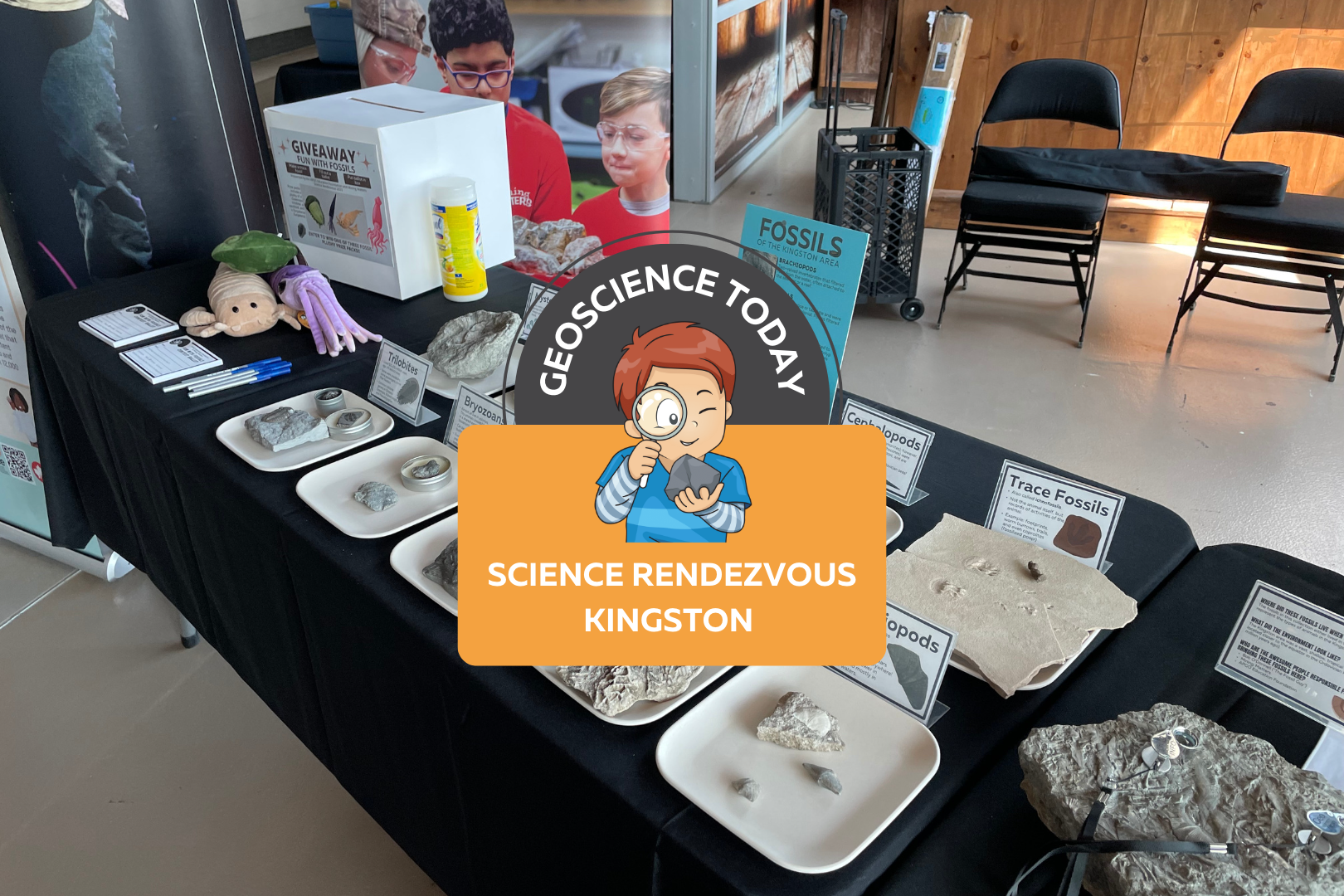
The APGOEF table at Science Rendezvous with fossils and stuffed animals. On top of the image text reads "Geoscience today: Science Rendezvous Kingston"

AGPOEF at Science Rendezvous Kingston

The APGO Education Foundation was excited to participate in Science Rendezvous in Kingston on May 13th, 2023! APGOEF has attended Science Rendezvous Kingston in previous years, and it has always been an incredible outreach event.  The day started with opening ceremonies where the official town crier announced the decision to make May 13th, 2023, the official “Science Rendezvous Day.” The town crier along with the mayor opened the doors at 10am to allow the crowd of families into the Leon’s Centre on the Tragically Hip Way by Kingston’s waterfront.  APGOEF collaborated with Mining Matters to create a fun table about the fossils of Kingston! Our booth was right next to the entrance to the Leon’s Centre and the crowd was instantly lining up to take a look at our fossils. We had an extensive fossil collection on display; some of which were donated to us by Bob O’Donnell.  We engaged kids by handing out stickers that said “I love fossils.” The kids loved them, putting them on their hands and t-shirts or tucking them away safely into their tote bags provided by Science Rendezvous. We also brought our signature colour-changing pencils, which are always a hit at any event we go to. We showed the children how, if you rub the pencil between your hands, it will change from black to pink or blue! Everyone was obsessed with the pencils and we handed out 500 or more.  We also had an interactive trace fossil activity with Play Doh. We provided an assortment of invertebrate fossils such as brachiopods, bryozoans, and corals, and encouraged people to press the fossils into the Play Doh and lift them out leaving behind a pattern. These patterns are similar to how trace fossils are made when the organism is alive, and sometimes all we have preserved of an organism is records of its behaviour in the sediment and not the animal itself! We also had some fun trace fossils on hand to surprise kids, such as footprints and coprolites (fossilized poop!) Once the kids were finished playing with the fossils and Play Doh, they moved further down the table to take a look at some cool fossil samples that could be found in the Kingston area. We explained how Kingston used to be under a massive shallow sea, and how all the sea creatures we see fossilized here used to live in the sea. We encouraged kids and parents to look around the limestones of Kingston to see some of the same fossils that were displayed here. At the end of the table we held a giveaway for three really cute fossil plushies as well as a copy of Four Billion Years and Counting, the beautifully illustrated geology textbook. We had families fill out a slip of paper answering questions about the fossils they interacted with in order to enter the giveaway. We picked three winners from the ballots the following day and mailed them their prizes. Approximately 1,300 people visited our booth during the 5 hour event. We really enjoyed talking to parents, kids, and individuals about the fossils of Kingston. A lot of the children expressed interest in fossils and some said that they had some fossils or rocks at home already. One child mentioned that he found a fossil on the way to school recently, and a few kids said that they loved dinosaurs. Although we didn’t have any dinosaurs at our table (you won’t find any dinosaur fossils in Kingston, or Ontario generally), we were still excited to connect with the kids about their passions.  The other organizations at Science Rendezvous all had incredible booths! We did not have much of a chance to walk around and see the other exhibits because we were so busy, but the whole event looked like a big success.  We would like to thank Science Rendezvous Kingston for having us again this year and for hosting such an incredible event. We also want to thank Bob O’Donnell for donating some of the beautiful fossils that really made our table a hit. We look forward to doing this again in the future!     Veronica Klassen is the Manager of the Foundation’s blog – Beneath Your Feet: A Geoscience Blog. She studied Arts and Science at McMaster University with a minor in Earth Science and has a Master’s in Science Communication from Laurentian University. She is passionate about making science accessible and engaging to the public.

Read More »
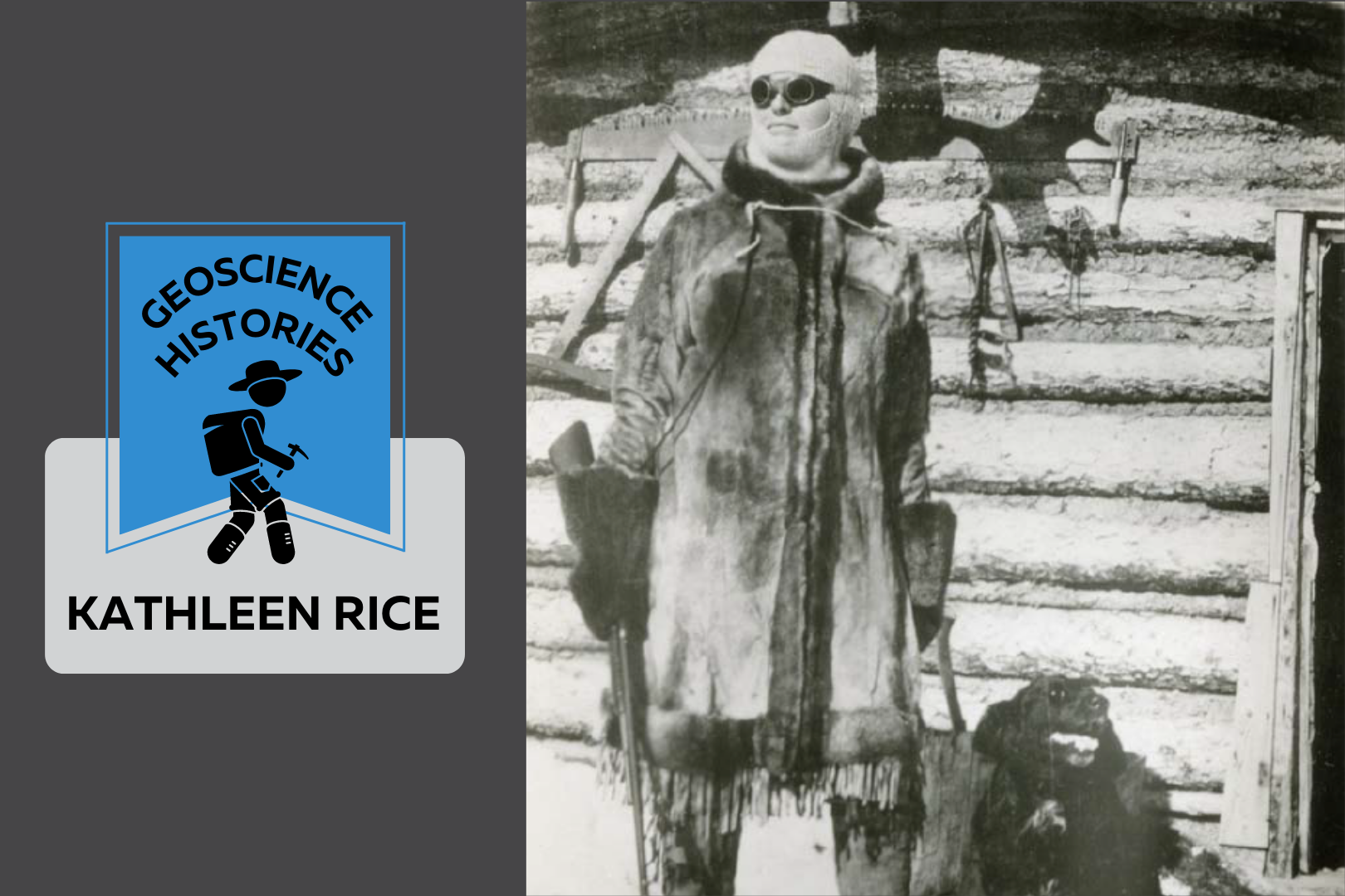
Black and white photo of Kate Rice. She stands looking into the distance dressed in a large coat and dark sunglasses. She is holding a gun and behind her is her log cabin. Beside the photo text reads: Geoscience Histories. Kate Rice.

Geoscience Histories: Kathleen Rice

Kathleen (Kate) Rice, also known as the Lady of the Lake, was an adventurer, prospector, wilderness survivalist, musher, hunter, trapper, and writer—despite living in a time where it was considered improper for middle- and upper-class women to do any of these things. She defied the expectations put on her as a single woman and lived her life in the wilderness of Northern Manitoba. She consistently chose nature over civilization and became proficient in the skills necessary to make a life for herself as a mineral prospector. Born in St. Mary’s Ontario, Kate’s parents taught her a love of nature growing up. Her dad showed her how to canoe and camp and told her stories of pioneering and exploration. Kate’s dad wanted to be an explorer himself, but instead took a more practical job teaching. Her father’s dreams and aspirations were possibly part of the reason that Kate became an explorer herself. Kate Rice studied mathematics, physics and astronomy in the early 1900s at the University of Toronto. She was awarded the prestigious Edward Blake scholarship twice and became a math teacher once she graduated. She was smart and gifted, but it wasn’t all easy going for her. When talking about teaching in a very male-dominated subject, she described that she was “constantly up against a feeling that [she] ought not to be there” (CIM Magazine). Maybe it was this feeling that drove Rice to live alone in the woods, or maybe it was simply the call of nature. In 1911, Rice moved near the Rocky Mountains for a teaching job and decided to take up mountaineering. She explored the Cascade Mountains and joined the Alpine Club of Canada, falling in love with a life outdoors. After only 5 years of teaching, she decided to give up her job and move up North to start a homestead. The Canadian government at the time was encouraging European settlers to explore the “new frontier”—Canada’s North. Of course, northern areas of Canada were not in fact new or unexplored, as Indigenous peoples had lived and travelled there since time immemorial. Kate moved up North as a colonial settler, which makes it difficult to decipher the true nature of Kate’s relationship with Indigenous people. We do know that she forged friendships with local Cree people, learned to speak Cree, and learned many life skills from her friends. However, the colonial nature of Canadian exploration adds complexity to her relationship with the Cree people which we cannot discount. Although the Canadian government wanted settlers to move up North, Kate was not legally allowed to buy land. Women weren’t considered people in Canada until 1929, so she enlisted her brother to buy a piece of land for her in his name. She bought a piece of land north of The Pas in Manitoba and she moved there in 1913. She started gardening, farming, fishing and writing, but there were many skills that she had to learn in order to survive on her own in Northern Manitoba. It was around this time that there was a gold rush near Beaver Lake. Rice decided to teach herself everything she could about geology and prospecting in the hopes of staking a claim for gold. In 1914, she hired a Cree guide to take her by dogsled to Beaver Lake. She continued from there by canoe to Brochet where she tried her hand at prospecting. She found some zinc and vanadium at Reindeer Lake, but she decided not to stake a claim there because it was inaccessible due to the lack of a railway. The following year, she hired “Old Isaac,” a local Cree elder, to take her back to Beaver Lake. She learned from Old Isaac how to shoot, hunt, trap, and mush dogs. It’s said that he called her “Mooniasquao,” or white woman. It was on this trip that she staked her first claims for gold and base metals near Beaver Lake. In 1916, she entered a prospecting partnership with Richard “Dick” Woosey. Dick had moved from England to Canada at age 25 with his wife, but his wife strongly disliked life in the bush and returned to England soon after. Dick and Kate connected and worked as prospectors together. She moved into his cabin on Chisel Lake, but despite rumours that they were romantically involved, Kate always made clear that their relationship was strictly a business partnership and friendship, nothing else. Almost 10 years later, Rice and Woosey built a cabin together on Assessment Island in Wekusko Lake. The island would later get renamed Rice Island for the 16 different prospecting claims that they made there. Woosey and Rice created the Rice Island Nickel Company in 1928 and attempted to sell their claims for $1 million. They were offered $500 000 but held out for a better offer. Instead of getting the payoff they had hoped, Kate and Dick ended up selling the claims to INCO for $20,000 many years later. Although they may not have seen much payment for the claims, Rice and Dick’s discoveries of copper and nickel were the reason that INCO originally came to Northern Manitoba, eventually turning Thompson into an important mining hub. At around 60 years old, Dick Woosey passed away, leaving Kate alone on the island. She continued to write, garden, fish, mush, and trap— taking care of the homestead for another 20 years after his death. She took her small 12ft canoe called “Duckling” on prospecting trips all over Manitoba and beyond. Kate was a skilled musher, becoming known for her ability to raise and train sled dogs, as well as mush without using a whip. She became somewhat of a local celebrity in Toronto where the rest of her family lived. Whenever she came to visit them, she would be hounded by papers wanting to write about her adventures. Although Kate never catered to the journalists, she did write several articles and scientific papers. A main topic for her writing was the Aurora Borealis because, after all, she

Read More »
Grey and red stones. Text overlay reads "Geo Careers. Sisyphus Mountain, A career reflection by Melanie Siewert, President of PGO"

Sisyphus Mountain: A Career Reflection by Melanie Siewert, President of PGO

In ancient Greek mythology, Sisyphus is known as the guy destined to push a rock up a mountain for all of eternity, with the rock rolling back to the bottom of the hill each time. For those that do not know the rest of the story, King Sisyphus was a mortal man, known for his arrogance. He made demands of the gods, claiming that his feats as a mortal made him worthy of becoming a god. He claimed he deserved, even demanded, that the gods grant him immortality. The Greek gods were ever obliging but in their twisted way, their gifts were rarely without a price. It is thought that the gods responded to King Sisyphus’ arrogance by rewarding him with a lesson in humility. This story of incessant effort with no reward is often used as a metaphor for our daily slog –  wake up, go to work, put in your hours, come home, go to sleep and do it all over again tomorrow. If this is what you are doing, you are not living a fulfilling career. You are merely collecting a pay cheque. It shouldn’t be that way! After over twenty years practicing as a geoscientist, I often get questions about what I like about my profession and what keeps me engaged. Indefinitely, my answer revolves around lifelong learning. I’ve seen a lot of change in the industry over my time. When I started in the industry, I thought it was about soil, rocks, water and their interactions with contaminants. Since that time, I’ve learned that a career in environmental consulting is about much more than the physical matrices we assess. I’ve learned about various site characterization and remediation technologies, human health and ecological risk assessment, ecological considerations, environmental liability and legal considerations. I’ve seen regulation changes that made previously ‘clean’ sites contaminated once more. I’ve even seen the evolution of methods to deal with contaminants of concern that had not even been identified when I first started practicing. Over the years, I’ve learned invaluable lessons about health and safety, professional ethics, client satisfaction and staff motivation. Some lessons were not necessarily by choice, like experiencing the look of disdain on the face of a driller’s helper that I sent home because he showed up at the drill site in running shoes or experiencing the gut-wrenching feeling of shutting down a job site after hitting a buried line after the public utility locator rushed and missed a traffic line. Other lessons are earned, like the understanding of how different contaminant plumes migrate and the telling evidence to suggest a commingled plume. And some lessons come from investing 10,000 hours in listening to client needs and learning how to tailor the products we provide to satisfy project specific objectives.  One of the most fulfilling aspects of my profession is passing those lessons on to the next generation of professionals: explaining the importance of listening to clients and hearing what drives their decisions. Is it fear of a health and safety incident or fear of a financial audit? Or is their priority protecting site aesthetics like a showcased tulip garden at a public park or avoiding disruptions to site operations like a profitable coffee drive through at a gas station. Or teaching reporting staff that how we present results can be as important as the actual results. I had a tough lesson very early in my career that always stuck with me. A reporter from a small town newspaper took a sentence from my publicly accessible environmental report and presented it out of context. It left me keenly aware of the importance of making every sentence count. I am immensely proud to know that young professionals that I have mentored over my career are now found throughout our industry in regulatory positions.  In my career, I’ve been blessed with daily challenges and opportunities for problem solving. I once visited a job site to perform a safety observation on field staff. Instead, we spent most of our time troubleshooting our drilling location as site logistics wouldn’t allow us to place the borehole where we needed to characterize soil contamination. Sitting in the van after finding a workable solution, he asked me “Have you ever had a job run exactly as planned?” I searched my memory bank and came up with nothing. Consulting is an industry of thinking on our feet and managing change. That same individual from the van left me thoroughly impressed when he applied his determination to a monitoring site where we had “lost” a well for several monitoring events. Other monitoring teams had been to the site and reported back that they couldn’t find the well based on the measurements provided. I remember the look on that determined individual’s face when he said “I saw that well before. I know I can find it.”  And he did! It had incorrectly been recorded relative to two adjacent survey pins; when he shifted his search to the next set of pins, the well was at the exact measurements provided on the figure. I find I have met the most interesting people over the years because consulting attracts people that thrive in an environment of discovery and change. For my part, I have never shied away from accepting those opportunities.  I’ve learned that geoscience is more than geology. You need to be part historian and part detective to piece together a complete conceptual site model. You need to be part interpreter and part politician to bring the right group of technical experts to the table to collaborate on multidisciplinary projects. Any environmental consultant will tell you that there is never a dull moment. We are masters in logistics and contingency planning. If your day to day feels like you are merely punching a time clock, perhaps you are not listening to what the universe is offering.  So back to the guy with the rock. There is an alternate theory to explain the lesson the Greek gods had for King Sissyphus. In

Read More »
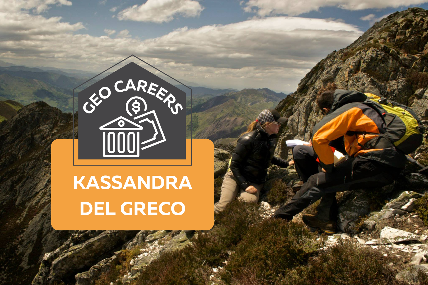
Photo of two people climbing a mountain range. On top of the photo text reads: "Geo Careers: Kassandra Del Greco."

GeoCareers: Kassandra Del Greco

When asked if I could write a little something about my career in geoscience, my gut response was, “I’m not sure I’m qualified to write something.” However, with a little reflection and persuasion, I thought it might be beneficial for others to read about how far an education in geosciences might actually take you. My initial interest in geology came out of my decision to take a “bird” course in CEGEP (Collège d’Enseignement General Et Professionnel), a type of junior college that encompasses the equivalent of grade 12 and the first year of university, to alleviate the heavy math and physics schedule I had lined up for one term. I signed up with a friend, thinking “Won’t it be nice to take a really easy class this semester” and soon found myself completely enthralled with learning about Earth’s history and systems. When university applications came around later that year, I began to consider that the career as a mathematician I had envisioned for myself didn’t quite make sense and I soon found myself wandering over to the geology, mining engineering, and geophysics booths at the McGill University open house. I was reminded during my visit to McGill that I knew two women who had graduated from McGill’s geology program. Two young women from my community, who I knew from extracurricular activities, had graduated with McGill geology degrees a few years prior and from what I could see on Facebook, were living adventure-filled lives working as exploration geologists in places like Australia and Africa. Growing up I had limited travel opportunities; it suddenly occurred to me that there are literally rocks all over the planet and that in theory, I could work anywhere in the world as a geologist, and with a career as a geologist, I might have the opportunity to visit places I’d never dreamed of before. What really sealed the deal was when I heard about the famous “Willy Trips” at McGill’s geology department, where Dr. Anthony Williams-Jones travelled to different destinations with a class of students every year to explore and learn about the geology of a new country. I was hooked. I went through university taking every opportunity to attend as many field trips as I could, and visited places like Chile, Tanzania, Columbia and the Southwest United States during my studies alone. I was so excited to begin my career as an exploration geologist and visit places like the remote Canadian North, Australia, Africa, South America…you name it. Everything was on track until 2012, the year I finally graduated. I entered the job market, top of my class, ready to begin working as an exploration geologist in mid-2012. Little did I know that 2012 would mark the beginning of one of the longest commodity and mining market downturns in history. It was difficult to find a job as an experienced geologist, let alone a freshly graduated geologist with just a summer’s worth of experience. I hustled as much as anyone, applying to literally any job I could find in the industry, but like many of the peers I graduated with, had no luck. It was disheartening, to say the least. After about 8 months of unemployment, I began looking at graduate studies opportunities. I thought that maybe I could either pursue a career in academia, or at the very least, hide out during a Masters degree and hope that within a couple of years the industry would turn and entry level jobs would begin to reappear. During my Masters degree at the University of Victoria I studied the structural geology and tectonics of the Cantabrian mountains in Northern Spain and was fortunate enough to spend a summer in Spain doing field work and attending conferences with geologists from the University of Salamanca. I finished my M.Sc. in mid-2016 and two hours after submitting my final thesis I was called by my first ever boss in the Quebec mining industry who I worked for a summer prospecting. He asked me if I was looking for work (I was) and told me about an opportunity for field work that summer (Holy cr*p, my plan worked!). I had my boots on the ground in Northern Quebec about two weeks later and was thrilled to, four years later, be starting my career as an exploration geologist. It was about 18 months of bliss, working multiple consecutive contracts in exploration for multiple gold exploration companies in Quebec. I was working on rotations that were 21 days on, 10 days off, or 14 days on, 14 days off. Of course, I took every opportunity to travel on my time off, living out of a duffle bag for months on end, visiting places like Portugal, Nicaragua, Costa Rica, and Italy. Essentially, I would go anywhere I could get to for a reasonable price and with less than 7 hours of flight time. However, it was about two years later when I started to feel the pains of the job. It turned out that as much as I loved learning about geology in school, I didn’t exactly love the work. I wasn’t totally enthused by core logging, learning to create geological models, or even spending time in the field. I was beginning to feel worn down by the swamps, the bugs, the heavy bags full of rocks, and spending whole days in the bush soaking wet. On top of this, I started to become acutely aware of the fact that I had no community. Over nearly two years, I had barely spent any time at home, causing me to feel disconnected from friends, unable to get involved in any type of club or activities at home, and forget dating, it was impossible! I began to reflect on whether this was the career for me. Sure, I loved learning about geology, and I loved travelling, but I didn’t really enjoy the work or the life I had built for myself anymore. I began searching for a mentor (I found a great one). I started writing

Read More »