A hiker stands on the top of an outcrop looking over a distant mountain scene. Text reads: "Beneath Your Feet. A geoscience podcast."

Rocky the Raccoon Children’s Book: Interview with Katie Maloney and Alexander Young

In this episode, I sit down with author Katie Maloney and illustrator Alex Young to talk about their brand-new children’s book Rocky the Raccoon Explores the Niagara Escarpment, which is directly aligned with the Grade 4 Ontario science curriculum. We dive into the art of science communication—how to take complex ideas and transform them into fun, accessible stories that spark curiosity. Katie and Alex share what it was like to bring Rocky to life, from the creative process of writing and illustrating to the challenges of making geology engaging for kids. We also discuss why it’s vital for scientists to share their work with the public, and how teachers can use Rocky the Raccoon as a classroom resource. Listen now: You can also listen to our podcast on these platforms: Audible Apple Podcasts Spotify Read along with the podcast transcript: Introduction Hello, everyone. Welcome to Beneath Your Feet, a geoscience podcast. I’m Veronica Klassen, science communicator, geology enthusiast and your host. Here at the APGO Education Foundation, our mission is to spark curiosity and passion for the geology of Ontario. Whether you’re a geology nerd, science enthusiast, or nature lover, this podcast is for you. Join us as we geek out over fascinating geology, uncover the hidden storiesand secrets of our extraordinary planet and explore the captivating world beneath your feet. Veronica Klassen Hello, everyone, and welcome to another episode of Beneath Your Feet. Today I’m going to be talking to Katie Maloney and Alex Young, who’ve been writing and illustrating a children’s book about the geology of the Niagara Escarpment. Rocky The Raccoon, which is out now, is a story about a raccoon exploring the Niagara Escarpment, learning about geology and the environment. The goal of the book is to educate, inspire kids to get outside and explore the natural environment. So thank you guys so much for joining me. Why don’t you start by telling me a bit about yourselves? Who are you and what do you do? Katie Maloney So I’m Katie Maloney. I am a paleontologist and I’m currently a Rebanks fellow at the Royal Ontario Museum, so studying some of the fossils in their collection. I did my Ph.D. and Master’s at University of Toronto and my undergrad at McMaster, and then I did a short post-doc at McMaster, kind of working on this project and another postdoc at McGill University, working up in the Arctic on some older fossils that are about a billion years old. And I’ll be starting at Michigan State this August. Alexander Young And my name is Alex Young. I’m a biomedical communicator and freelance medical illustrator, which doesn’t necessarily mean a ton, we’ll get into what those mean probably later on in the podcast. But broadly, I would consider myself a scientific communicator that focuses on visuals. And so Katie asked if I could help illustrate this book, bring Rocky to life. And given the fact that I can draw most of the time, and also I am able to relatively accurately convey that science because of my background, that’s why I got brought onto the project. And why I can do the things accurately? Well, I did my Master’s at UofT in medical illustration and science communication, and prior to that I did my undergrad at Mac in Integrated Science, which is actually where I met Katie and Carolyn, the other co-author on the book. So, yeah. Veronica Perfect. Thanks so much, guys. So I am so excited to hear about this book that you are working on. So how did this project come about? Where did the idea originally start? Katie So the idea for the book originally started when I was a Mitacs postdoctoral fellow at McMaster University, and so we had a project working on geoscience communication, trying to sort out how we could have people be more engaged with the Niagara Escarpment, since it affects everyone’s everyday lives throughout the Hamilton Niagara area. And so the project originally started with several undergraduate students who were supposed to work in a lab during COVID. And then when the COVID pandemic hit, they were not allowed in the lab space at McMaster University. So instead what they did is they rode their bikes along the Niagara Escarpment and picked out different areas of interest. So the project was in motion long before I joined. But when I joined in 2022, it was a lot of putting the data that these students had gathered over several years together and making it accessible for the public. And then Deana, who works for the APGO Education Foundation, puts all this fantastic information and data into these story maps that people can access online and use to have a virtual guide to these trails. Veronica Okay, awesome. And how did you get connected to this Alex? Alex So I got brought in as an illustrator once they got sort of some funding and the project evolved into, you know, how can we make this a more engaging experience to introduce the topics and the subject matter to the school system as well. And sort of with a focus on, you know, local schools that are adjacent to the Niagara Escarpment, but beyond that, as well what would be useful for Ontario students given the curriculum and what they’re taught about earth sciences at the elementary school level. And once they realized that they wanted to do an illustrated book that could connect to elementary school students, then Katie and Carolyn co-author got in touch. They knew that I had been in ISci with both of them, Carolyn was our prof, and then I had sort of moved into this capacity as a medical illustrator and they thought that it would be a good fit for the book. And then it became a very fun mash up of like personal, because obviously I have so much respect for Katie and Caroline and being able to work with them again is
Read More »
A hiker stands on the top of an outcrop looking over a distant mountain scene. Text reads: "Beneath Your Feet. A geoscience podcast."

PODCAST EPISODE 3: From Books to Bedrock: Student life with Keira Hum

In this episode, we sit down with Keira Hum, a passionate Integrated Science student at McMaster University, to explore the ins and outs of student life in the world of Earth Sciences. Keira shares her journey from the classroom to the field, offering invaluable advice for balancing academics, personal growth, and career aspirations. Whether it’s navigating coursework, finding opportunities in the geoscience community, or preparing for a future in the field, Keira’s relatable stories and practical tips are sure to inspire students and geoscience enthusiasts alike. Tune in for a fun and insightful conversation packed with guidance for thriving in geoscience studies! 🌍🎙️ Listen now: You can also listen to our podcast on these platforms: Audible Apple Podcasts Spotify Read along with the podcast transcript: Introduction Hello, everyone. Welcome to Beneath Your Feet, a geoscience podcast. I’m Veronica Klassen, science communicator, geology enthusiast and your host. Here at the APGO Education Foundation, our mission is to spark curiosity and passion for the geology of Ontario. Whether you’re a geology nerd, science enthusiast, or nature lover, this podcast is for you. Join us as we geek out over fascinating geology, uncover the hidden storiesand secrets of our extraordinary planet and explore the captivating world beneath your feet. Veronica Klassen Thanks so much for joining me. Today I’m here with Keira Hum, a third year university student at McMaster. We’re going to be talking about some tips and ideas for being in school, studying geology,all those sorts of things. And I think it’ll be a really good conversation. I’m really excited to talk with you. Keira Hum I’m really excited to talk to you, too, Veronica. I’m excited to kind of talk about my job and experience going through a geoscience program. VeronicaYeah, for sure. All right, so why don’t you just start by introducing yourself? Who are you? What do you do? KeiraSo, yeah, my name is Keria Hum. I go to McMaster, and I’m in the Integrated Science program. I’m going into my fourth year of study and I have a concentration in Earth and Environmental Science. So I do a lot of, like, scientific research and take a lot of environmental electives. VeronicaAwesome. How does it feel being almost done? KeiraPretty good. I know I’m going to miss my friends a lot so that I’ll be going over my mind throughout the year and kind of thinking about master’s programs too, right now. So that’s been what I’ve been doing. VeronicaYeah. And how did you get where you are now? So how did you originally become interested in geoscience and what was that journey like for you? KeiraSo in my first year of undergrad in my Integrated Science program, we did have an introductory lecture and course in Earth and Environmental Science, and I really enjoyed that compared to like all the other courses that we had to take. And I just thought the Earth Science course was so much more fun and so much more interactive. And I also took an intro to Environment, Climate and Water, and I thought that was really interesting too. And I had a bunch of field events, which was really fun, and I thought, you know, can’t hurt to try going into that concentration. And I’m so glad that I did. VeronicaYeah, that’s awesome. And I think I remember you saying that you were not imagining that you would do Earth Science before university. You had a different track in mind. Is that the case? KeiraYeah. I was thinking I would go into biology. That’s kind of what I was interested in during high school. But getting introduced to the course at a university level and the concepts I thought was really interesting. I really like the idea of sitting in the classroom, learning about the concepts and then doing labs outside and in the field. That was really interesting to me and I learn so much better in those kind of environments. So it was kind of perfect for me. Yeah, and I just thought, it’s so applicable to so many different types of disciplines, like I could do biology and geoscience if I wanted, or earth and environmental science and biology. And I really liked how the discipline can, kind of, interact with so many other ones. VeronicaYeah, definitely. That’s one of the things that I also love about geology is just like how universal is and like it relates to so many different scientific and also nonscientific areas of study. KeiraYeah, for sure. VeronicaAnd you also said that you decided to try to get your PGO certification. So could you tell us a bit about how that process has been for you? KeiraYeah. So I first got introduced to what PGO is and the importance of it in my first year of study. So I was kind of thinking about it and trying to plan my courses for the PGO and because I’m in ISci, it’s hard to manage my electives just because I have limited space every year. So I had to do a lot of planning field courses and extra courses during the summer and spring terms just so I can make up all the knowledge requirements to get the PGO certificate. So it’s been a lot of planning and stress, but I know it’ll be worth it in the end. Yeah, I love the courses that I’m taking anyway that are required for the PGO knowledge requirements, so I find it, you know, not too difficult and pretty enjoyable because I’m getting more exposure to courses I might not have noticed or taken if it wasn’t for the PGO requirement list and seeing the course offerings on that document. VeronicaRight? Yeah, it’s different things that necessarily you would always get to get to explore. So that’s cool. On that note, do you have any other piece of advice that you would give for younger students who are maybe considering PGO or geoscience in general? What

Read More »
A hiker stands on the top of an outcrop looking over a distant mountain scene. Text reads: "Beneath Your Feet. A geoscience podcast."

PODCAST EPISODE 1: Devonian Discoveries: Fossils at Wainfleet Wetlands with Paleontologist Dr. Daniel Dick

Join podcast host Veronica Klassen and guest paleontologist Dr. Daniel Dick as we delve into the creation of a GeoHike at Wainfleet Wetlands. Discover the unique ecosystem of the middle Devonian period through an array of fascinating features: encounter colonial organisms, massive corals, glacial striations, and pop-up structures. We’ll discuss potentially undiscovered fossils, augmented reality animations to bring fossilized animals to life, and what counting layers on rugose corals can tell us about the speed of the Earth’s rotation in the Devonian. Episode Audio: You can also listen to our podcast on these platforms: Episode Transcript: Dr. Daniel Dick (Dan) It looks like an ecosystem where the water was just drained out of it. It feels alive and it will really help you understand just how different the world used to be. I think that is the main thing that makes paleontology interesting. It just shows you that the world has changed so much, and it will blow your mind. [musical interlude] Veronica Klassen Hello, everyone. Welcome to Beneath Your Feet, a geoscience podcast. I’m Veronica Klassen, science communicator, geology enthusiast and your host. Here at the APGO Education Foundation, our mission is to spark curiosity and passion for the geology of Ontario. Whether you’re a geology nerd, science enthusiast, or nature lover, this podcast is for you. Join us as we geek out over fascinating geology, uncover the hidden stories and secrets of our extraordinary planet, and explore the captivating world beneath your feet. [musical interlude] Veronica All right, let’s get started. Today, I’m going to be talking to Daniel Dick, who is a researcher at McMaster University. Daniel, why don’t you start by telling us a bit about yourself? Dan Yeah, I mean, you covered quite a bit there. I’m Dan. I’m a postdoc at McMaster, primarily working on this public outreach project that we’ve been developing over the last few years. Which, in conjunction with the APGO Education Foundation, is developing this website, GeoscienceINFO, and primarily we are working on the GeoHikes. Research-wise, I’m a paleontologist. I focus primarily on fossils. I work on mass extinction events and trying to understand the dynamics of them, with the end goal of hopefully applying some of the knowledge we might learn from past extinction events to help us understand contemporary extinction dynamics and areas of risk and things like this. Yeah, so, my research sort of takes me all over. It’s primarily focused on Ordovician-Silurian fossils. So that’s a lot of stuff that we find here in Ontario, but also in other parts of Canada and the United States and such. Veronica Amazing. So how did you originally get interested in geoscience? Like, what led you here? Dan I’ve definitely been interested in it for a very long time. I have photos as a kid at the Royal Tyrrell Museum staring at the fossils, and you can sort of see that it’s already something I’m obsessed with at that point. But the beginning of the journey, I think, was in high school because my high school actually had Earth science courses up to grade 12 in B.C., where that’s sort of more standard. And I’d kind of forgotten how much I like geoscience, I think until those late courses. And it reminded me, oh yeah, I forgot that this was a thing. And that was something that I enjoyed and was good at as well, which helped. Veronica So, it was kind of high school, then you decided to study it in university. Did you go straight into geoscience? Dan Yeah, I didn’t actually go straight into it. I went into evolutionary anthropology, so I was focused more on human evolution and human fossils and things like that. But then found myself realizing that the questions and things I was more interested in could more easily be answered by working with non-human fossils, because you need large numbers of things, so you need lots of fossils in order to start to understand things like extinction dynamics and climate change and all that kind of stuff. And so, I switched over to more standard and invertebrate paleontology at that point for my Ph.D., which then looked at those kinds of questions. Veronica So, when you say those kinds of questions, you’re talking about extinction events and how we can learn from that? Is what you mean? Dan Yeah, absolutely. Yeah. Veronica Yeah, for sure. And just for a little bit more context do you want to explain kind of like what the GeoHikes are, what’s like the purpose of the GeoHikes? Dan For sure. So basically, like the GeoHikes are kind of a, they’re sort of a freely accessible trail guide in a literal sense, that’s what they are. They take you along an existing hiking trail that has some sort of geologically interesting features on it, and there’ll be a series of stops which will take you to these different features and will describe for a general audience what’s going on geologically. Occasionally we do other things beyond geology. We also look at ecology, for example, talk about invasive species or we’ll find fossils on some of the hikes, and we’ll talk about ancient ecosystems or mass extinctions or whatever it is we’re doing. And my personal vision for them, is I see them sort of as a living first year Earth science lecture. They’re simple in the sense that they should be understood by anyone. But instead of having a textbook figure or something explaining the process of erosion or soil formation or something, you go to a physical location where this is all on display. And so, the figure that you would normally look at in a textbook is now there in front of you in real life and offers an opportunity to learn this. Ideally, the way I see it is if you do enough of these GeoHikes, you will get all the basic information you would need to understand, you know, the sophistication of

Read More »
A geologic map showing different coloured rock units. Text over the map reads: "Geoscience Today. Introductory Resources for Exploring the Geology of Ontario."

Introductory Resources for Exploring the Geology of Ontario

A note from APGOEF:  Today we are publishing something a bit different than our regular blog posts! It is our primary goal at APGOEF to educate and spread awareness about geoscience, so when Ken Lyon presented us with this comprehensive list of resources, we couldn’t resist sharing it with our readers. We hope you will find this compilation useful to your exploration of earth science. APGOEF does not take responsibility for the content of the resources provided, and cannot vouch for their validity. Preface The following is written by: Ken Lyon, MSc, P.Geo, kenlyongeo@gmail.com, Peterborough, ON The impetus for this compilation of over 50 publications and internet resources came from Laura Mancini of the Ontario Geological Survey. Laura reached out to me in 2021 in my capacity as Newsletter Editor of the Kawartha Rock and Fossil Club. She had been contacted by someone who was looking to explore the geology of Ontario, and wondered if the Kawartha club might have something to help. Laura’s question fit in with a list of resources that I had started compiling for rockhounds, field naturalists and other people who like these kinds of things. Perhaps now more than ever with climate change and related issues front-and-centre, we are coming to appreciate that geoscience is hugely significant and fun to learn about and explore. In compiling this list, I have tried to offer some guidance by assigning levels to the resources ranging from Level 1 for those who know nothing or little about geology to Level 3 for those who feel comfortable with basic concepts. Resources marked with a * are particularly recommended. I have included some of my favourite books that cost money and also many good resources that are free of charge. Level 3 and beyond takes you into the worlds of serious mineral, rock and fossil collectors and people who have taken college and university courses. This is not to say that you need formal study. I am constantly learning from members of the Kawartha and other clubs who are self-taught and know more about some topics than I ever will. This compilation is a work-in-progress and I have made some minor revisions since 2021. Hopefully, you will find a few “nuggets” of information to help you get out and have some fun. Amethyst rock from Thunder Bay area, ON. Photo: Ken Lyon Amethyst is a purple variety of quartz and the official gemstone of Ontario. The reddish-brown crystals on the left are amethyst crystals coated with the iron mineral, hematite. The length of the rock shown is 40 cm. My wife bought this as a treasured addition to her rock garden. Acknowledgements While I take responsibility for selection of the resource list and comments, I would like to gratefully acknowledge review comments and encouragement provided by the following in alphabetical order: Andy Fyon, PhD, formerly of the Ontario Geological Survey; Kevin Kidd of the Kawartha Rock and Fossil Club and the Gem and Mineral Club of Scarborough; Laura Mancini, MSc, PGeo, of the Ontario Geological Survey; Bill Pearson, PhD, PGeo, and Deana Schwarz, PhD, PGeo, of the APGO Education Foundation; and Ashley Pollock of the London Gem, Mineral and Fossil Society, the Walker Mineralogical Club, and the Central Canadian Federation of Mineralogical Societies (CCFMS) Some Important Precautions and Disclaimers You are responsible for knowing where you can go, where you can park, what safety hazards may exist and what personal protective equipment you need, and what you can pick up and take back home. Parking rules change from road to road and place to place.  Respect all laws and rights governing private and Crown property, and obey all rules and regulations covering any access to and from any of locations. Bedrock outcrops and other locations can pose traffic, slip-trip-fall and other hazards. The use of hammers can be dangerous and in some cases destroys the outcrop for future observation. Rock, mineral and fossil samples cannot be removed from protected areas such as parks and conservation areas or from private property without permission. If you are rockhounding, please follow the CCFMS Code of Ethics for Rockhounds (https://ccfms.ca/Copied_Field_Trips.php) and Safety for Field Trippers (https://ccfms.ca/CCFMS-Safety-Rules.php). I have not personally visited most of the sites listed and cannot vouch for the accuracy of the content of the resources. And finally, I have to disclaim any liability in connection with the use of the information presented and my annotated comments and recommendations. Great Unconformity bedrock outcrop at Galesburg just northeast of Peterborough in The Land Between. Photo: Ken Lyon Paleozoic Ordovician limestone about 450 million years old overlying Precambrian granitic mountain core about 1 billion years old; incredible time spans. Annotated List Alphabetically by Author (or source when no author is available) Resources marked * are particularly recommended. Level 1 Resources Brachiopod and bryozoa fossils in limestone near Lindsay, ON. Photo: Don McLeod used with permission. Don maintains a good nature blog at https://www.donaldmcleod.com Fossiliferous Ordovician limestone about 450 million years old. At the time we were under a warm shallow sea south of the equator. The large fossil is about 3 cm across. Other Museums, Science Centres, Geo-Parks There are many museums and other facilities across southern Ontario that feature geology exhibits. Here are a few that were recommended by my reviewers: Arkona Lions Museum –  Arkona, ON Bancroft Mineral and Mining Museum, Bancroft, ON Canadian Museum of Nature, Ottawa, ON Hooper Virtual Natural History Museum – Carleton University, Ottawa, ON Metcalfe Geoheritage Park – Almonte  Miller Museum of Geology, Queens University, Kingston, ON Oil Museum of Canada, Oil Springs, ON Science North – Sudbury, ON Additional Fossil Resources Some additional fossil references recommended by my reviewers are listed below: Level 2 Resources Physiographic features of the Peterborough – Stoney Lake, ON area. Small portion of Physiography of the South Central Portion of Southern Ontario. Ont. Dept. of Mines and Northern Affairs, Map 2226. Scale 1:253,440. © Queen’s Printer for Ontario 1972. Reprinted 1984 with minor revisions. Features shown include till moraine (purple), sand plains

Read More »
Landscape with mossy boulders and shrubs with a forest in the background. There is fog making the photo blurry. Text on the photo reads: "Geoscience Today. 7 Beautiful Autumn Hikes in Ontario"

7 Beautiful Autumn Hikes in Ontario

Looking to explore Ontario this fall season? Autumn is one of the best times to grab a warm drink and get outside to appreciate the colourful landscape.  Here’s a list of some of the best hiking spots across Ontario. Each of these places has a unique history, geology, flora, and fauna. The fall colours in Ontario are generally best between mid-September and mid-October, but Ontario Parks also publishes a map showing the changing colours across Provincial Parks in Ontario! The fall colour map is updated weekly with current colours at each park, so make sure to check it out before you go! If you do go to any of these locations, be sure to come prepared with water, snacks, and emergency first aid. Please check the park or trail’s website before going to ensure they are open and see if you need to pre-book a parking spot. Some places close late October for the winter season, so make sure to double check that the trail is open before you leave. In order from south to north, here are the hikes to check out this fall: Point Pelee is at the southernmost point in Ontario, and is known for its diversity of ecology and wildlife. The autumn season sees visits from migrating Monarch butterflies on their way south. Visit the park from late August to mid-October in the early morning or just before sunset for a chance to view these gorgeous migrating butterflies. Point Pelee has a diverse mix of ecosystems including the Lake Erie Sand Spit Savannah – a unique mix of Red Cedar Savannah, Shoreline Savannah, and woodland. The difference between a savannah and a woodland or a forest has to do with the amount of light that reaches the undergrowth. In a savannah, less than 25% of the ground is covered by the canopy, allowing light-loving plants to grow underneath the trees. A woodland is defined by 25-50% canopy cover, and more than 50% cover is a forest.  At Point Pelee you can also find a large marsh home to frogs, turtles, muskrats, snakes, insects, fish, and zooplankton; a swamp forest home to many species of birds, frogs and butterflies; and a dry forest with unique trees and wildflowers. Learn more about the ecology of Point Pelee on the Government of Canada website or on the Ontario Parks Blog. The hiking and walking trails at Point Pelee are also accessible to strollers and wheelchairs. Check out the trail maps here to plan your visit. 2. Dundas Peak Dundas Peak in Hamilton Ontario is surrounded on all sides by a gorgeous deciduous forest full of vibrant autumn colours. Standing on a large outcrop on the Niagara Escarpment, Dundas Peak overlooks the Spencer Gorge to the cliffs of the Escarpment beyond. Dundas Peak is located in the popular Spencer Gorge Conservation Area, where visitors come to see either the view from the peak or the two large waterfalls in the area. Note that entering the conservation area requires a booked appointment and a paid parking spot. Please read the Conservation Hamilton website carefully before you go, as they have recently made changes to limit the number of people on the trails. If you want to avoid the crowds, local blogger Lauren Yakiwchuk recommends the Sydenham lookout as a good alternative to Dundas Peak with almost the same view. 3. Pinery Provincial Park Pinery Provincial Park lies on the shores of Lake Huron and boasts beautiful oak trees. Due to its southern location and the moderating effect of Lake Huron, the trees at Pinery change colour later in the fall season and will be at their peak between mid-October and early-November. Pinery is also home to a very rare ecosystem – an oak savannah.  Not only is the savannah rare, but the very landforms that make up Pinery Provincial Park are also unique. Pinery is situated on sand dunes formed over the last 6,000 years. Did you know that less than 0.5% of Ontario is made up of coastal sand dunes? About 7,500 years ago, most of southern Ontario was covered in one large lake called Lake Nipissing. As Lake Nipissing receded, sand and rocks were moved southward along the Eastern coast of Lake Huron from Grand Bend towards Kettle Point (see map below). Checkout the Friends of Pinery website for different hikes to try at Pinery. Creation of Dunes at Pinery Provincial Park. © King’s Printer for Ontario, 2019. 4. The Cheltenham Badlands The Cheltenham Badlands are famous for their unique geological formation. The rolling red rocks were formed 450 million years ago at the bottom of a lake. These rocks, part of the Queenston Shale Formation, were exposed over the years due to poor farming practices that eroded the topsoil. The red rocks match the red autumn leaves in the fall, adding to the magic of the landscape. There is also a 1.4 km hike in the conservation area that takes you through the forest surrounding the exposed rocks. The conservation area was previously closed to the public in order to preserve the rocks, but has since been reopened with a boardwalk over the rocks. The boardwalk is wheelchair accessible and there are educational information signs along it. You can no longer walk on the rocks in order to preserve them and prevent quick erosion of the landform. Make sure to go to the Cheltenham Badlands website to book a spot at least one day before you go. 5. Algonquin Provincial Park Algonquin is famous for its expansive forest and wildlife. Algonquin has forests of sugar maples and red maples, which turn brilliant orange and red colours in the fall. The colours will be at their best between mid-September and mid-October. There are so many walking trails that it can be hard to choose which one to do. Even if you visit Algonquin many times, there is always something new to see. The Fire Tower Trail in particular has a great lookout over the fall colours at the

Read More »
Aerial image of a turqoise river with white water. Surrounding the river is cliffs with greenery. Text on top of the photo reads "Geoscience Today. The Niagara Gorge Geotrail."

The Niagara Gorge Geotrail

The beautiful Niagara Gorge is made up of steep walls that rise on either side of the Niagara River, downstream of Niagara Falls, extending to Queenston, Ontario (and Lewiston, New York, depending which side of the river you’re standing on). The gorge itself is a geoscientist’s dream. The colourful rock units that lie one on top of the other may look like layers on a wedding cake but are in fact more like pages of a really good book (see image 1). Our book begins in the Late Ordovician Period, approximately 448 million years ago, at the bottom of the gorge, just above the river’s surface, with a long and juicy chapter called the Queenston Shale. The plot oscillates throughout the book as you read upwards through chapters of dolostone, limestone, sandstone, and shale. The book ends powerfully (note: spoilers ahead) in the Late Silurian Period (about 425 million years ago) with the limestones and dolostones of the Lockport Group, located at the very top of the gorge. The composition of each rock unit can tell us so much information about what the environment was like here, water depth, the types of organisms that lived at the time that the sediment was deposited, and much more. We don’t see giant 11-kilometre-long rock walls like this everywhere, so who or what do we have to thank for this geologic feature? Turns out, it’s just water being water. Southern Ontario has been through its fair share of glacial events. The most recent glacial event, called the Wisconsin Glaciation, lasted roughly 75,000 to 11,000 years ago. The amount of ice that was present in the area cannot be overstated; an ice sheet approximately 1-3 kilometres thick covered the Niagara region! As you can imagine, once this ice started to melt, it produced massive amounts of water. It was all this water that reshaped the water landscape of Ontario, creating new lakes, rivers, and streams, in addition to carving out land features that affect drainage patterns. The Niagara River was formed from this glacial meltwater, as it flowed from early Lake Erie to what is now Lake Ontario (but was the ancient Lake Iroquois at the time). When the Niagara River first started to flow, it would fall over the Niagara Escarpment at its original location, flush with the rest of the escarpment in the Queenston area. It didn’t take long, however, for the water to start eroding away at the escarpment in the river channel (see image 2). The rock units of the escarpment vary in their resistance to erosion. Shale, for example, is more easily eroded by fast-flowing water than limestone. As such, these rock units would erode away first beneath the top Lockport Group layer of dolostone and limestone (we call this top erosion-resistant layer a “caprock”), which would eventually lead to the dolostone/limestone caprock breaking off due to a lack of underlying support. Over the last 12,000 years, Niagara Falls has moved upstream (due to erosion) approximately 11 km! This makes it one of the fastest moving waterfalls in the world (see video below)! Even though Niagara Falls gets all the glory, no trip to the area would be complete without visiting the Whirlpool. Located downstream from the falls, it has a maximum depth of 83 metres and produces such powerful currents that the resulting change in water levels resembles marine tides (see image 3)! When the falls eroded from the rest of the Niagara Escarpment to the location of the Whirlpool, it began to erode through the ancient glacial sediments that had filled in the St. David’s Buried Gorge. These glacial sediments were less resistant to erosion than the surrounding Paleozoic sediments, so more erosion occurred here, forming a wider section of the gorge. This also caused the Niagara River to change direction; this direction change is responsible for the turbulent waters in the Whirlpool (see image 4). The Niagara Whirlpool area has some fantastic geology that can be visited in person, but you have to know where to look. The Niagara Gorge Geotrail, available through GeoscienceINFO.com is a great resource that not only provides exact map-based GPS locations, but it also tells you what geological features you are looking at and how they formed. The Niagara Gorge Geotrail begins by setting the scene beside the Niagara Glen Nature Centre. At this stop you are standing directly on the Wintergreen Flats, which at this location form a promontory – a point of high land that extends out as a headland. Stop #2 provides a fantastic view of the magnificent rock units of the escarpment on the American side. This is best viewed in the early afternoon, as the sun lights up the different coloured layers of shales, sandstones, dolostones, and limestones. When you look at this horizontal rainbow of rocks, think about the different environments that were present at the time they were deposited. From the deeper seas that deposited the shales, to the shallower seas of the sandstones, to the often-busy metropolises of marine organisms that led to the limestone deposits. If fossils are your thing (which I know they are), stops three and five have just what you need. A giant fossilized coral reef allows you to play detective and search for all kinds of little critters from bryozoans to little now-disarticulated crinoid ossicles that once stood tall one on top of each other, holding up the fleshy part of the animal in its calyx at the top. A fallen block of dolostone contains a fossilized trilobite, a class of invertebrates that went completely extinct just before the dinosaurs came on the scene, approximately 250 million years ago (see image 5). The Geotrail wraps up with a large rock block with a strange-looking tunnel in it. It looks like this tunnel was man-made, as it’s exceptionally round and extends right through the rock. This tunnel, actually called a “pothole”, was naturally made through the abrasive action of rocks and water. Potholes form through the repetitive circular movement of

Read More »
The Niagara Escarpment in the distance at sunset. The cliff is surrounded by autumn coloured trees. On top of the photo text reads: "Geoscience Today. The Niagara Escarpment is crumbling- here's how, and why you should care."

The Niagara Escarpment is Crumbling—Here’s How, and Why You Should Care

If you visit or live near a geological landform, such as an escarpment, waterfall, or hillslope, you may notice that rock debris accumulates over time. Patrons of the Niagara Escarpment’s Bruce Trail, for instance, can observe rock blocks ranging from the size of a cell phone to a small car. To a hiker, fallen rock may not seem concerning. Yet what happens when geology meets urban infrastructure? The Niagara Escarpment is a large sedimentary landform which spans 400km across the northeastern United States and southern Ontario. Composed of dolostones, limestones, sandstones, and shales from the Paleozoic Era, its face is steep and heavily fractured. Each stratum, or layer, of rock has a unique composition which dictates its susceptibility to erosion. For instance, thick, resistant layers of the Irondequoit dolostone are often undercut by the softer Rochester shale which erode at a faster rate. This produces sharp overhangs which create angular blocks when there is not enough rock to support the overlying material. The escarpment bisects a number of urban areas, such as Hamilton, Ontario, where it is integrated into city infrastructure. This poses significant risks because the fractured escarpment face experiences frequent rockfalls which threaten the safety of citizens and have caused considerable infrastructure damage. For many years, the reason for the rapid weathering rates observed on the escarpment was unknown. New research has revealed the role of temperature changes in the development of fractures. How is the Escarpment Weathered? There are a variety of processes responsible for the weathering of rock, such as be chemical, mechanical (e.g., cracking), fluvial (e.g., flowing water), or biological (e.g., tree roots) in nature. However, the escarpment’s location in a temperate climate is unique because it is subject to cold winters and warm summers. This means that temperature plays a significant role in freeing rock from the escarpment face. Freeze-thaw weathering describes processes which create fractures in rock by causing water contained within pores or pre-existing cracks to freeze and thaw over time. When water freezes, it expands. This forces apart a body of rock from the interior, often producing stresses which exceed the strength of the rock. Freeze-thaw processes can occur within individual pores saturated with water, or on larger scales where ice lenses accumulate in pre-existing cracks. During the winter months, this form of weathering produces debris ranging from small flakes to large angular blocks.  Thermal weathering is similar to freeze-thaw in that it involves fluctuations between warmer and cooler temperatures. Rock expands during warming and contracts during cooling, which causes the rock to deform throughout the day.  Over time, these temperature cycles can create enough stress to cause fractures to develop. This is referred to as thermal fatigue, because each fluctuation is not individually powerful enough to fracture the rock, but over time the stresses accumulate. Conversely, thermal shock describes events of rapid temperature change (which can range from 1°C to over 10°C per minute) that induce high stresses as the rock expands or cools. This can cause instantaneous cracking.  These weathering processes are not limited to geological landforms. Sidewalks, buildings, and even prehistoric rock art are all susceptible to temperature changes.  How is Weathering Studied? At McMaster University, our research group studies these processes from a variety of perspectives. My work implements a network of remote temperature probes installed at exposed rock outcrops across the escarpment. At each site, probes are inserted into pre-existing fractures and affixed to the rock surface to measure temperature at one-minute intervals. This reveals changes on short time scales which enables us to identify thermal shock events and freeze-thaw cycles. By collecting data year-round, the temperature probes also provide information about the seasonality of fracturing.  To assess the spatial distribution of weathering, an infrared thermal camera is employed which photographs differences in surface temperature across rock outcrops. Our group uses a rock trap (pictured below), to collect samples of falling rock generated by weathering processes. This is paired with drone-based 3D models which enable us to identify the rate of weathering and location in which blocks have fallen from the escarpment face.  My research also involves climate modelling to predict future changes in weathering intensity using a suite of regional climate models.  Climate Change Our research suggests that climate change may exacerbate weathering processes by increasing the range of temperatures experienced by rock throughout the day. In exposed rock faces, the surface warms rapidly in comparison to pre-existing fractures which are insulated from atmospheric conditions. This creates a thermal gradient between the fracture and rock surface—during the day, the surface is warmer than fractures, whereas at night the fractures are insulated from cooling and remain at higher temperatures than the surface.  As the climate warms, this effect will be exacerbated. Repeated warming and cooling will increase the gradient of temperature between the surface and fractures, promoting processes such as freeze-thaw and thermal weathering which are predicated on thermal cyclicity.  Shifts in the amount of precipitation may also play a role. In areas where climate change will bring increased rain and snowfall, moisture conditions will raise the likelihood for freeze-thaw expansion in rock. This further raises the likelihood for fractures to grow. Why Should I Care? The Niagara Escarpment is well integrated into urban infrastructure. Rapid rates of weathering and the location of exposed rock walls poses significant safety risks to commuters and pedestrians alike.  The portion of the escarpment which passes through the city of Hamilton, Ontario is a pertinent example. Between 2007 and 2017, there were nearly 40 damage claims from falling rocks, and eight major rock falls over a two-year span each incurring $25,000–$500,000 in costs. While the city spends $300,000 annually to update preventative erosion measures, research suggests that numerous areas remain susceptible to rockfall and require $12 million in protective measures. Commuters along the Niagara Escarpment routinely experience rock hazards, such as a 2016 event in which a truck-sized boulder nearly struck cars along the 403 Highway.  These issues are not unique to the Niagara Escarpment alone—geological landforms in all temperate environments

Read More »
Two photos of Niagara Falls. The one on the left is grey and cloudy. The one on the right is bright and sunny. In front of the photos text reads: "Geoscience Today. GeoscienceINFO celebrates five years of serving the public."

GeoscienceINFO Celebrates Five Years of Serving the Public

The APGO Education Foundation is thrilled to celebrate five wonderful years of sharing our favourite subject with you – geoscience — via GeoscienceINFO.com. The Foundation itself was created in October 2014 as a charitable foundation with two main goals in mind: to help people in their journey in becoming geoscientists, and to provide accurate, reliable, and up-to-date information about geoscience to the public. We began our mission to help inform the public about geoscience by creating our website GeoscienceINFO.com on June 8, 2017. In the beginning, we had two main features we wanted to share with the public: geology-based virtual field trips of locations across Ontario, and short-but-informative Geovideos that explain geoscientific concepts and processes. To provide the highest-quality information to the public, we knew we couldn’t rush things. We started with one virtual field trip, one Geovideo, and a whole lot of enthusiasm! Virtual Field Trips The first virtual field trip released on GeoscienceINFO.com was of the Niagara area in southwestern Ontario, and this virtual field trip continues to be popular today. We were so excited to bring this field trip you the public that we first visited the Niagara peninsula in January to take photos! Needless to say, many of these photos were eventually replaced once the ice thawed and the trees started to bloom. Using Google Earth, seven stops in the Niagara peninsula were chosen for their geological relevance. Each stop has a detailed description of the geological history and relevance of that location. Because we know that learning is a highly visual process, we wanted to include as many photos of each stop as possible. This is why we have a well-stocked section at each stop of photos of the outcrop from as many angles as possible. In addition, we have a section of hand samples to give you a look at what the rocks and minerals are like close-up. Since 2017, we have continued to add more virtual field trips from locations all over Ontario. As of June 2022, we now have 17 virtual field trips available to the public, ranging from Thunder Bay to Ottawa. To better serve our public, we upgraded our platform in 2021 to the latest ArcGIS-based software offered by ESRI. This means our maps are quick to load, easy to navigate, and are supplemented by many high-quality and fast downloading photos. Geovideos In November 2017 we released our first Geovideo entitled “Where Does My Water Come From?” This two-and-a-half-minute video explains from where most people in Ontario receive their drinking water. Did you know that half of people in Ontario get their water from surface water bodies such as the Great Lakes? Knowing that piquing people’s interest is best for active learning and retaining facts, we wanted the Geovideos we released to be relatively short, accurate, and full of interesting facts like this that people can think about long after the Geovideo is over. Since 2017, we have released a number of Geovideos that explain geological processes and concepts. Our Geovideo “How Do Volcanoes Form?”, released in 2018, is our most popular video to-date with over 115,000 views! In 2020 we released a six-part series of Geovideos as part of our “Why Geoscience is Important” spotlight. From metal and mineral exploration to remediating disturbed lands, geoscience is associated with a broad range of activities and processes. As the world moves toward renewable energy sources, mining will continue to play a vital role as we need minerals such as copper, silicon, and silver to construct solar panels to harvest the Sun’s energy. Our Geovideos highlight the continuing importance of geoscience and answer commonly asked questions about various subject matter. Story Maps Our virtual field trips are set up like the university geology field trips that professors and students go on to learn more about geoscience. It’s important to us that everyone can experience this type of learning atmosphere. As such, they do have some limitations. Although our virtual field trips are full of information and photos, we wanted to give people more in order to truly immerse them in the area about which they are learning. ESRI’s new Story Map platform was the perfect way for us to do that. In November 2021, we released the first Story Map, of the Arkona area, at the Geological Association of Canada/Mineralogical Association of Canada (GAC MAC) conference in London, Ontario. In addition to the Arkona virtual field trip, presented in a new format, this Story Map provides a very detailed geological history of the region, and more paleontological environmental information, supplemented with a broad range of media types. Video segments of interviews with professors and local experts, drone footage, 360-degree photos, animations, 3D LiDAR imaging, and unique graphics are all included to provide a multi-faceted learning experience. Audio is also provided for all text, to augment accessibility options for the reader. We are so excited to be able to offer both options to learn about an area: our traditional virtual field trip, and our detailed Story Map. We will be creating Story Maps that will accompany all our virtual field trips, so be sure to look for these in the future! Beneath Your Feet: A Geoscience Blog One of our latest releases is the launch of our blog, Beneath Your Feet: A Geoscience Blog. We weren’t joking around when we decided to release a blog! Veronica Klassen, who has completed an M.Sc. in Science Communications, joined our team in 2021 to oversee the production, launch, and organization of our new blog. Because geoscience (like all science) is a dynamic field that is constantly growing, learning, and expanding, it’s important that we let the public know about the latest research. We publish articles bi-weekly, and articles are written by either our staff or by guest writers who are experts in their field. We feature columns by geoscience professors, students studying geoscience, licensed Professional Geoscientists (P.Geo.s), and local experts. If you’re practicing or studying geoscience and have something you’d like to communicate with the

Read More »
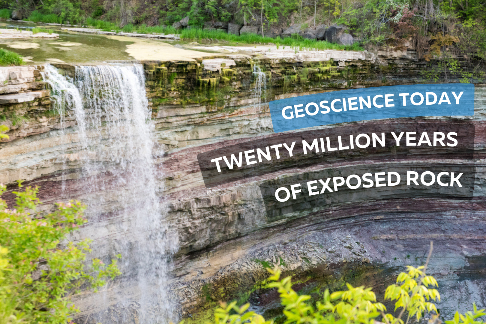
Photo of balls falls showing the water flowing over rock layers. Text on top of the rock reads "Geoscience Today. Twenty million years of exposed rock"

Twenty Million Years of Exposed Rock

This article has been republished with permission from the Niagara Peninsula Aspiring Geopark website. Read the original article here. The Balls Falls Conservation Area, located prominently on the edge of the Niagara Escarpment, beautifully exposes a succession of Upper Ordovician and Lower Silurian rocks along a length of over 2.5km and a vertical dimension of about 65m. This excellent exposure is the result of river and slope erosion dominated by the northward flow of Twenty Mile Creek, over the Upper and Lower Falls, and ultimately into Lake Ontario. Paleozoic Geology Aside from the Niagara Gorge, Balls Falls is one of the few locations in the Geopark where bedrock formations are so well exposed to reveal the geologic history of the region. As shown on this geologic cross section, rock seen along the length of the valley spans a time of roughly 20 million years from the Upper Ordovician Queenston Shale to the Lower Silurian Lockport Formation Limestone. Many of the rock layers can be seen at the Lower Falls located next to the grist mill. It is astounding to realize that from this single vantage point, one can witness so much of the earth’s history. The oldest visible rock formation, the Power Glen Shale (438 my), lies at the base of the falls and the youngest, Reynales Formation Limestone and Shale, is seen at the top. Formations both younger and older are exposed along the valley. Overlying Rochester Shale and Lockport Dolostone form the structure of the Upper Falls while older rocks are exposed below the Lower Falls – buff coloured Whirlpool Sandstone is seen within the gorge walls and river bed and the Queenston Shale Formation, the oldest rock exposed in the Geopark, outcrops further downstream in the prominent cliff just north of King St. The Waterfalls The Upper and Lower Falls are located at two different levels in the stratigraphy. These two levels were created by a combination of scouring glacial action, ending as the last glacier retreated about 12,000 years ago, and by the erosive power of flowing water – most significantly as torrential glacial melt runoff at various periods in history, and later in a more subdued manner as drainage along Twenty Mile Creek. The Upper Falls at 11m high is classified as a curtain falls since the width is greater than its height. About 1.5km downstream, the main Lower Falls at 27m high is considered a classical falls because the height and width are almost equal. Further downstream there is a collapsed waterfall that formed over the course of the past 10,000 to 12,000 years, as the rock layers receded due to erosion. The Gorges The erosional history of the Gorges at Ball’s Falls is complex. Today, you see two active gorges – one below each of the two waterfalls. They have been excavated by two, and possibly more periods of erosion, separated by phases in which the entire area was covered by glacial ice. When the ice last retreated (which was at its peak was at least 1km thick) it left the area covered with glacial till, clay and silt thereby plugging these previously excavated sections of the gorge. As the glacier retreated and water flowed again in the gorge, the weak and loosely consolidated glacial remains were washed out and the “buried gorge” was revealed again. There are also two abandoned gorges – one on the west side of each of the two waterfalls.  These abandoned gorges were active over 25,000 years ago.  The Valley Slopes Weathering on the steep slopes of the gorges gives rise to two main types of slope movement: individual rock falls and rock slides. Individual rock falls take place unnoticed most of the time and is very common on open exposed cliff faces. Large rockslides take place less often – once every six to ten years – but produce a much more obvious result. In 1981, a slide on the east side of the valley occurred as rock at the top of the slope failed, slid down the slope towards the gorge floor and forced the closure of the road. This occurrence was an excellent example of how the gorge evolves – the gorge enlarges and rock is delivered to the river channel to be gradually eroded and carried downstream. The River and Water Flow Twenty Mile Creek is named for the location of its mouth, twenty miles (32 km) west of the Niagara River along the Lake Ontario shoreline. The Indigenous name for the Twenty Mile Creek is the Kenachdaw, which translates to Lead River. It is 50 km in length and drains an area of roughly 290 sq km. River flow in the river normally dries up in the late summer and early fall, although there can be considerable variation in the timing. The largest flood events are usually between January and April as rainfall and melting show pack on saturated ground with little vegetation cover often combine to produce dramatic floods. At the Upper Falls, water flows underground and re-emerges at the cliff on the east side of the falls. Contributor: Niagara Peninsula Conservation Authority Author (photo on left): Perry Hartwick, P.Geo, Niagara Peninsula Aspiring Global Geopark Director and Resident Geologist, Co-founder and President of Upper Canada Stone Company, Ltd., which successfully operates a dozen quarries in Ontario under the Aggregate Resources Act.

Read More »