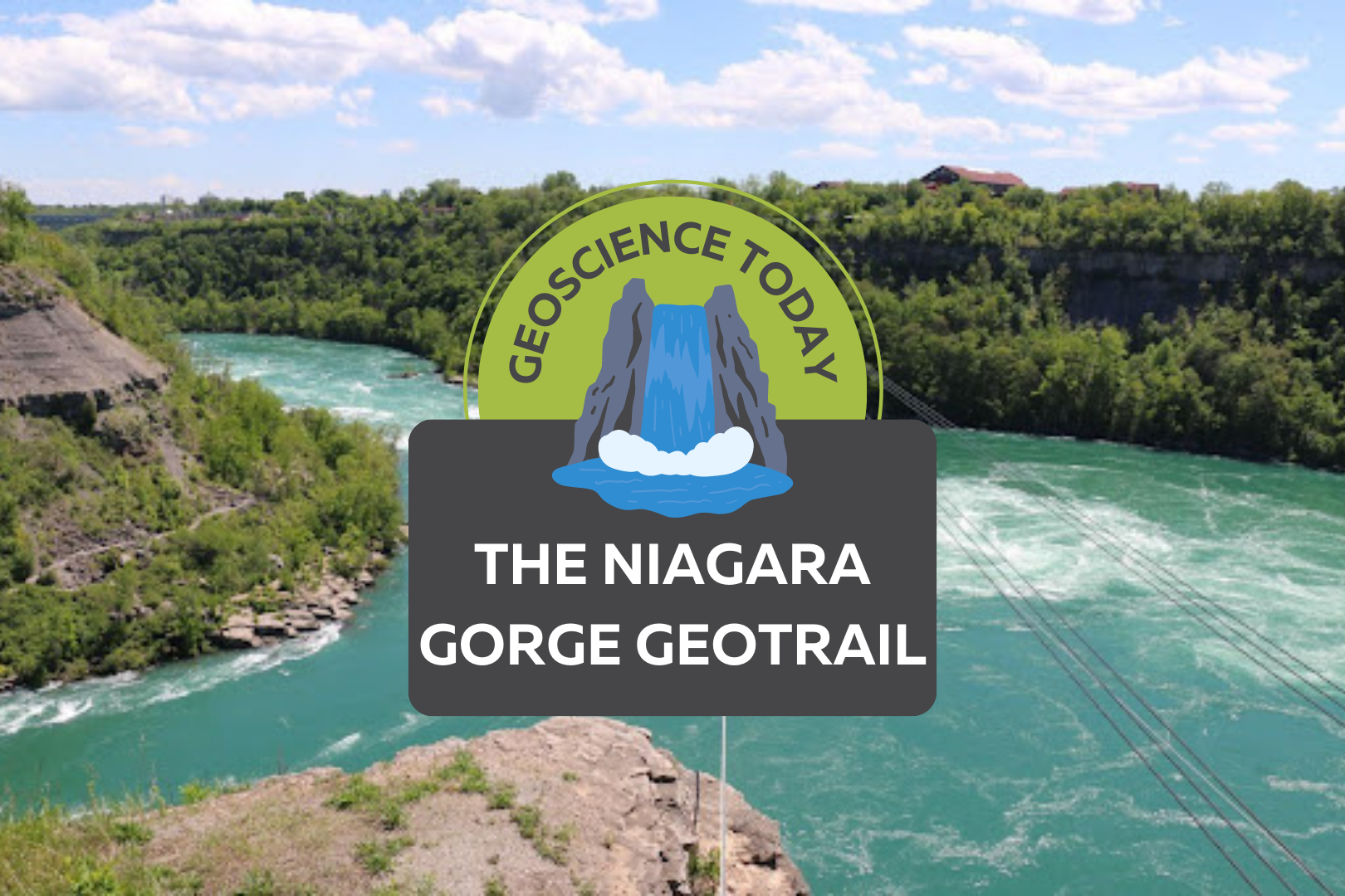
Aerial image of a turqoise river with white water. Surrounding the river is cliffs with greenery. Text on top of the photo reads "Geoscience Today. The Niagara Gorge Geotrail."

The Niagara Gorge Geotrail

The beautiful Niagara Gorge is made up of steep walls that rise on either side of the Niagara River, downstream of Niagara Falls, extending to Queenston, Ontario (and Lewiston, New York, depending which side of the river you’re standing on). The gorge itself is a geoscientist’s dream. The colourful rock units that lie one on top of the other may look like layers on a wedding cake but are in fact more like pages of a really good book (see image 1). Our book begins in the Late Ordovician Period, approximately 448 million years ago, at the bottom of the gorge, just above the river’s surface, with a long and juicy chapter called the Queenston Shale. The plot oscillates throughout the book as you read upwards through chapters of dolostone, limestone, sandstone, and shale. The book ends powerfully (note: spoilers ahead) in the Late Silurian Period (about 425 million years ago) with the limestones and dolostones of the Lockport Group, located at the very top of the gorge. The composition of each rock unit can tell us so much information about what the environment was like here, water depth, the types of organisms that lived at the time that the sediment was deposited, and much more. We don’t see giant 11-kilometre-long rock walls like this everywhere, so who or what do we have to thank for this geologic feature? Turns out, it’s just water being water. Southern Ontario has been through its fair share of glacial events. The most recent glacial event, called the Wisconsin Glaciation, lasted roughly 75,000 to 11,000 years ago. The amount of ice that was present in the area cannot be overstated; an ice sheet approximately 1-3 kilometres thick covered the Niagara region! As you can imagine, once this ice started to melt, it produced massive amounts of water. It was all this water that reshaped the water landscape of Ontario, creating new lakes, rivers, and streams, in addition to carving out land features that affect drainage patterns. The Niagara River was formed from this glacial meltwater, as it flowed from early Lake Erie to what is now Lake Ontario (but was the ancient Lake Iroquois at the time). When the Niagara River first started to flow, it would fall over the Niagara Escarpment at its original location, flush with the rest of the escarpment in the Queenston area. It didn’t take long, however, for the water to start eroding away at the escarpment in the river channel (see image 2). The rock units of the escarpment vary in their resistance to erosion. Shale, for example, is more easily eroded by fast-flowing water than limestone. As such, these rock units would erode away first beneath the top Lockport Group layer of dolostone and limestone (we call this top erosion-resistant layer a “caprock”), which would eventually lead to the dolostone/limestone caprock breaking off due to a lack of underlying support. Over the last 12,000 years, Niagara Falls has moved upstream (due to erosion) approximately 11 km! This makes it one of the fastest moving waterfalls in the world (see video below)! Even though Niagara Falls gets all the glory, no trip to the area would be complete without visiting the Whirlpool. Located downstream from the falls, it has a maximum depth of 83 metres and produces such powerful currents that the resulting change in water levels resembles marine tides (see image 3)! When the falls eroded from the rest of the Niagara Escarpment to the location of the Whirlpool, it began to erode through the ancient glacial sediments that had filled in the St. David’s Buried Gorge. These glacial sediments were less resistant to erosion than the surrounding Paleozoic sediments, so more erosion occurred here, forming a wider section of the gorge. This also caused the Niagara River to change direction; this direction change is responsible for the turbulent waters in the Whirlpool (see image 4). The Niagara Whirlpool area has some fantastic geology that can be visited in person, but you have to know where to look. The Niagara Gorge Geotrail, available through GeoscienceINFO.com is a great resource that not only provides exact map-based GPS locations, but it also tells you what geological features you are looking at and how they formed. The Niagara Gorge Geotrail begins by setting the scene beside the Niagara Glen Nature Centre. At this stop you are standing directly on the Wintergreen Flats, which at this location form a promontory – a point of high land that extends out as a headland. Stop #2 provides a fantastic view of the magnificent rock units of the escarpment on the American side. This is best viewed in the early afternoon, as the sun lights up the different coloured layers of shales, sandstones, dolostones, and limestones. When you look at this horizontal rainbow of rocks, think about the different environments that were present at the time they were deposited. From the deeper seas that deposited the shales, to the shallower seas of the sandstones, to the often-busy metropolises of marine organisms that led to the limestone deposits. If fossils are your thing (which I know they are), stops three and five have just what you need. A giant fossilized coral reef allows you to play detective and search for all kinds of little critters from bryozoans to little now-disarticulated crinoid ossicles that once stood tall one on top of each other, holding up the fleshy part of the animal in its calyx at the top. A fallen block of dolostone contains a fossilized trilobite, a class of invertebrates that went completely extinct just before the dinosaurs came on the scene, approximately 250 million years ago (see image 5). The Geotrail wraps up with a large rock block with a strange-looking tunnel in it. It looks like this tunnel was man-made, as it’s exceptionally round and extends right through the rock. This tunnel, actually called a “pothole”, was naturally made through the abrasive action of rocks and water. Potholes form through the repetitive circular movement of
Read More »
Two photos of Niagara Falls. The one on the left is grey and cloudy. The one on the right is bright and sunny. In front of the photos text reads: "Geoscience Today. GeoscienceINFO celebrates five years of serving the public."

GeoscienceINFO Celebrates Five Years of Serving the Public

The APGO Education Foundation is thrilled to celebrate five wonderful years of sharing our favourite subject with you – geoscience — via GeoscienceINFO.com. The Foundation itself was created in October 2014 as a charitable foundation with two main goals in mind: to help people in their journey in becoming geoscientists, and to provide accurate, reliable, and up-to-date information about geoscience to the public. We began our mission to help inform the public about geoscience by creating our website GeoscienceINFO.com on June 8, 2017. In the beginning, we had two main features we wanted to share with the public: geology-based virtual field trips of locations across Ontario, and short-but-informative Geovideos that explain geoscientific concepts and processes. To provide the highest-quality information to the public, we knew we couldn’t rush things. We started with one virtual field trip, one Geovideo, and a whole lot of enthusiasm! Virtual Field Trips The first virtual field trip released on GeoscienceINFO.com was of the Niagara area in southwestern Ontario, and this virtual field trip continues to be popular today. We were so excited to bring this field trip you the public that we first visited the Niagara peninsula in January to take photos! Needless to say, many of these photos were eventually replaced once the ice thawed and the trees started to bloom. Using Google Earth, seven stops in the Niagara peninsula were chosen for their geological relevance. Each stop has a detailed description of the geological history and relevance of that location. Because we know that learning is a highly visual process, we wanted to include as many photos of each stop as possible. This is why we have a well-stocked section at each stop of photos of the outcrop from as many angles as possible. In addition, we have a section of hand samples to give you a look at what the rocks and minerals are like close-up. Since 2017, we have continued to add more virtual field trips from locations all over Ontario. As of June 2022, we now have 17 virtual field trips available to the public, ranging from Thunder Bay to Ottawa. To better serve our public, we upgraded our platform in 2021 to the latest ArcGIS-based software offered by ESRI. This means our maps are quick to load, easy to navigate, and are supplemented by many high-quality and fast downloading photos. Geovideos In November 2017 we released our first Geovideo entitled “Where Does My Water Come From?” This two-and-a-half-minute video explains from where most people in Ontario receive their drinking water. Did you know that half of people in Ontario get their water from surface water bodies such as the Great Lakes? Knowing that piquing people’s interest is best for active learning and retaining facts, we wanted the Geovideos we released to be relatively short, accurate, and full of interesting facts like this that people can think about long after the Geovideo is over. Since 2017, we have released a number of Geovideos that explain geological processes and concepts. Our Geovideo “How Do Volcanoes Form?”, released in 2018, is our most popular video to-date with over 115,000 views! In 2020 we released a six-part series of Geovideos as part of our “Why Geoscience is Important” spotlight. From metal and mineral exploration to remediating disturbed lands, geoscience is associated with a broad range of activities and processes. As the world moves toward renewable energy sources, mining will continue to play a vital role as we need minerals such as copper, silicon, and silver to construct solar panels to harvest the Sun’s energy. Our Geovideos highlight the continuing importance of geoscience and answer commonly asked questions about various subject matter. Story Maps Our virtual field trips are set up like the university geology field trips that professors and students go on to learn more about geoscience. It’s important to us that everyone can experience this type of learning atmosphere. As such, they do have some limitations. Although our virtual field trips are full of information and photos, we wanted to give people more in order to truly immerse them in the area about which they are learning. ESRI’s new Story Map platform was the perfect way for us to do that. In November 2021, we released the first Story Map, of the Arkona area, at the Geological Association of Canada/Mineralogical Association of Canada (GAC MAC) conference in London, Ontario. In addition to the Arkona virtual field trip, presented in a new format, this Story Map provides a very detailed geological history of the region, and more paleontological environmental information, supplemented with a broad range of media types. Video segments of interviews with professors and local experts, drone footage, 360-degree photos, animations, 3D LiDAR imaging, and unique graphics are all included to provide a multi-faceted learning experience. Audio is also provided for all text, to augment accessibility options for the reader. We are so excited to be able to offer both options to learn about an area: our traditional virtual field trip, and our detailed Story Map. We will be creating Story Maps that will accompany all our virtual field trips, so be sure to look for these in the future! Beneath Your Feet: A Geoscience Blog One of our latest releases is the launch of our blog, Beneath Your Feet: A Geoscience Blog. We weren’t joking around when we decided to release a blog! Veronica Klassen, who has completed an M.Sc. in Science Communications, joined our team in 2021 to oversee the production, launch, and organization of our new blog. Because geoscience (like all science) is a dynamic field that is constantly growing, learning, and expanding, it’s important that we let the public know about the latest research. We publish articles bi-weekly, and articles are written by either our staff or by guest writers who are experts in their field. We feature columns by geoscience professors, students studying geoscience, licensed Professional Geoscientists (P.Geo.s), and local experts. If you’re practicing or studying geoscience and have something you’d like to communicate with the

Read More »
Kingston town hall. In front of the photo text reads: "Geoscience Today. A Celebration of Kingston Geology."

A Celebration of Kingston Geology

We at the APGO Education Foundation are always looking for an excuse to celebrate geology. What better way to do that than to sing the geological praises of the Kingston area! On Saturday, May 7, 2022, the APGO Education Foundation and Mining Matters will be hosting a table at the Science Rendezvous event in Kingston, Ontario, at the Leon’s Centre. We hope that you will drop by and talk a bit of shop with us, because we haven’t been able to talk about geology with you in person for so long! This year our theme is “The Geology of Kingston.” From May 7-22, we will be offering a geology themed scavenger hunt where you can earn your digital “Geo-Explorer Badge” of Kingston, and a chance to win one of five cool prizes. Choose from a list of geologically interesting rocks listed on our site, then visit a minimum of six of those rocks located either on Queen’s campus or along the Kingston Waterfront. Take an original photo of the rocks you visit, then submit them to us online. That’s it! If you have visited the correct rocks and submitted an original photo, then you will qualify to win one of five beautiful geology textbooks. Five winners will be randomly selected from qualifying entries. You can also visit us at our booth on May 7th to look at some rock samples of Kingston and talk about how they formed. Did you know that Kingston is also called the Limestone City? People used to build limestone buildings right on top of the limestone they excavated to make them! But limestone isn’t all that Kingston has to offer. Not even a little bit. To say that Kingston has a complicated past would be a big understatement. The area shows evidence of so many geologic events throughout the past billion-plus years that it requires a lot of detective work by geologists to try and piece these events together. Perhaps we’ll never know the full detailed story; however, we can be sure it will give geologists something to think about for centuries to come. To the northeast of Kingston lies a strip of Precambrian rock called the Frontenac Arch. It connects the Precambrian rocks of Algonquin Park to the northwest to those of the Adirondack Mountains to the southeast. The rocks themselves were formed between 1.1 to 1.4 billion years ago, the later stages of which were thought to be a time when there was quite a bit of volcanic activity, resulting in a lot of magma being deposited on the continent1. As if all this magma spewing all over the ground wasn’t enough excitement, the igneous rocks that formed from this magmatism were then deformed due to a process called metamorphism. This metamorphism was a result of an incredibly massive mountain-building event, or what geoscientists call “orogenesis”. This mountain building event is called the Grenville Orogeny, and it lasted until about 980 million years ago. The mountain range itself was massive – it ran from Labrador, Canada, down to Mexico, in a northeast to southwest direction. The mountains formed when at least two continental landmasses collided with Laurentia, the large North American continental landmass at the time. The term “collide” implies an immediate event. But the movement of continental plates is not instantaneous; average plate movement is 10 cm per year. While this rate of movement might seem inconsequential at first, remember that continents are ridiculously massive in size and just because they come in contact with another on-coming continent does not mean they stop moving! Once a continent collides with another continent head-on, the ground starts to buckle and has nowhere to go but up. Think about the last time you shoveled your driveway (brr!). When you put your shovel down, the snow is flat and beautiful, just as it was deposited. When you start to push your shovel though, the snow buckles and builds upwards, forming little mountain-like structures made of snow on your shovel. In orogenesis, instead of snow, the ground itself is pushed upward on a massive scale, forming mountains. Over many millions of years, the Grenville Orogeny was formed in North America, its western edge giving Kingston, Ontario a high five. You might be thinking “Wait, I’ve been to Kingston and there weren’t any mountains there!” You’re right… and you’re wrong. Like all good things, even mountains must come to an end. Once the continents stopped pushing into each other, the ground was no longer being pushed upwards and the mountain building phase ended. With no upward building, the mountainous sediments had nowhere to go but down. Over the next several hundred millions of years, the powerful effects of weathering and erosion wore the mountains down until not much remained but their roots. When you walk over the Frontenac Arch, you are walking on the roots of an ancient mountain! At one point in time, these very rocks were at the bottom of a mountain as tall as the Himalayan Mountains. With that amount of weight sitting on top of you, you can imagine things would get pretty uncomfortable. The rocks found in the roots of a mountain are commonly subjected to metamorphism. Because of the high temperatures and pressures there, they undergo deformation, which alters the original (or “parent”) rock to form a secondary, and ultimately, metamorphic rock. For example, if a granite rock is buried and subjected to high temperatures and pressures, it can turn into the metamorphic rock gneiss. When you stroll over the Frontenac Arch, you see lots of granite and its metamorphic product gneiss. You’ll also see marble, syenite, monzonite, migmatite, gabbro, quartzite and pegmatite2. As millions of years passed, the North American continent moved so that what is now Kingston was positioned near the equator. By the mid Cambrian Period (approximately 520 million years ago) this area became a shallow tropical sea –a stark contrast to its volcanic phase 700 million years before! By this time, life was in full bloom in

Read More »
Graphic with dinosaur footprints and a magnifying glass. Text reads" Geo Q&A: Where are the dinosaurs?" There is a missing poster with a dinosaur on it beside the text.

Where are the dinosaurs?

Dinosaurs were some of the biggest animals to ever roam our planet. This massively large group of reptiles were around from the late Triassic Period (approximately 230 million years ago) until they went extinct at the end of the Cretaceous Period, approximately 65.5 million years ago (not including their flying descendants, which evolved into today’s birds!). For a remarkable 165 million years, they were seemingly ubiquitous; dinosaur fossils have been found on every continent! When dinosaurs first evolved, Earth’s plates were arranged into one large continent called Pangea. This single-continent arrangement no doubt facilitated their migration to all corners of the globe. It should stand to reason therefore that if I start digging in my backyard here in London, Ontario, I should eventually find some kind of dinosaur fossil, should it not? Turns out, the answer is a disappointing no. Only disappointing, though, if dinos are your only area of interest. Don’t get me wrong, I love dinosaurs (although I would not want to meet one in a back alley. Or even a front alley); however, there is still a treasure trove of fossils just waiting to be uncovered here in Ontario. The fossils here are just much, much older than any dinosaur, because the time they lived in and thus the rocks that their remains eventually became fossilized within are much older. The rocks in southwestern Ontario range in age from the late Ordovician Period (about 455 million years) to the Late Devonian Period (about 360 million years). That is roughly 205-130 million years before the first dinosaur strutted on the scene! If there are no dinosaur fossils to be found in southwestern Ontario, does this mean that dinosaurs never lived here at all? Fear not. Ask any paleontologist, and they will all agree that dinosaurs almost certainly did live in what is now Ontario, Canada. The Mesozoic Era, sometimes colloquially called the Age of the Dinosaurs, lasted approximately 165 million years. During such a long geological time span, there were no doubt times of deposition that added to the rock record. Given that there would have been many billions of individual dinosaurs during that time, the remains of many little and big critters would have absolutely been buried in the sediments and later undergone fossilization across Ontario. So, the big question remains: where are the dinosaurs? Up until about 2.5 million years ago, these fossilized dinosaur bones were likely still in the rocks in southern Ontario, just waiting to be discovered by future paleontologists. But then something big happened. Something really big. Things started to get very cold. Global temperatures began to drop significantly, and ice sheets started to grow on the continents. The cause of this change to colder conditions isn’t as clear as you’d think for something that occurred relatively recently (at least in geological terms that is). If you ask three different respected geologists why, you might get three slightly different respectable answers. That doesn’t mean that two of them are wrong, it just means that the cause is likely a result of an interplay of different factors that all contributed to lower global temperatures. The position of Earth’s continental plates no doubt played a big factor in the overall cooling of the planet, as their arrangement greatly affects oceanic and atmospheric circulation patterns. Other variables such as atmospheric CO2 levels and even predictable changes to Earth’s orbit could have facilitated the cooling process.   In North America, the Laurentide ice sheet covered most of Canada and some parts of the United States a number of times, as it advanced and retreated repeatedly in cycles of growth and shrinkage in response to climatic conditions. You can imagine the havoc that a sheet of ice reaching a few kilometres in thickness would have on the ground as it makes its way forward and backward! The ice sheet literally scraped many layers of rock away, turning whatever got in its way into a fine powder called “rock flour”.  All those poor dinosaur fossils that waited so patiently to get their place of honour in a paleontology museum were instead ground up into dust. Far be it from the scientific community to see this as a bad thing. Although glacial activity removed the fascinating rocks layers of the dinosaur-saturated Mesozoic Era here in Ontario, it ended up exposing the just-as-fascinating rock layers of the even older Paleozoic Era! The rocks that lie at or near the surface in southwestern Ontario range in age from the Upper (or late) Ordovician Period (about 455 million years old) around the Belleville to Peterborough area and get progressively younger as you drive southwest towards the Arkona area, where they are late Devonian in age (about 360 million years old). Although the fossils found in these rocks differ among species, there are many common types of fossils found in many of the limestone, dolostone, and shale outcrops throughout southwestern Ontario, from Ordovician to Devonian rock units. Some of the most common types of fossils found in southwestern Ontario are corals. Although they look like plants, corals are actually marine animals that usually lived attached to the seafloor. The fossilized corals here in southwestern Ontario are either tabulate (colonial-type) or rugose (solitary and colonial type) corals, and if you find them, it can tell you quite a bit about what the environment was like when they were alive. Since they thrive in relatively shallow, warm, marine seas, we can reconstruct their living conditions and make some accurate conclusions about the environment when these rock units were deposited. There are also many other fossils to be found in these rocks, such as brachiopods, gastropods, bivalves, crinoid parts, trilobites, bryozoans, and much more. The animation here shows what life could have looked like in the shallow, tropical seas of the Devonian Period, in southwestern Ontario. This is all fine and dandy, but the question still remains: where are the dinosaurs? To find them, you’ll need either a good-working car or a plane ticket; however, you

Read More »