Text reads: Geoscience Today. Geoscience meets AI: Imagining tomorrow's possibilities.

Geoscience Meets AI: Imagining Tomorrow’s Possibilities

Mary-Anne Hildebrandt, P. Geo., FGC Energy and minerals power our lives, and while we Canadians live in a land of abundance, global projections of natural resource consumption far exceed what is readily available. Economic geologists are increasingly challenged to locate near-surface mineral resources that are feasible to extract. Today’s evolving business models focus on creating more precise, surgical methods of extraction, not only to reduce the environmental impact of mining, but also to unlock economic potential in deposits that, in the past, would not have met the threshold for Reasonable Prospects for Eventual Economic Extraction (RPEEE). In parallel, we are working in the era of Big Data. In 2020, NASA reported that its Earth Science data collection had reached 40 petabytes (PB), a unit 1000 times the size of a terabyte (TB) and that this collection was expected to expand to 250 PB within six years. Geoscience data in the mineral and mining industry follows a similar trend. Big data and increased complexity of the deposits make it essential that Professional Geoscientists (P. Geos) leverage Artificial Intelligence (AI) because traditional methods of analysis are often insufficient to handle the scale and complexity of modern datasets. There are many companies and software developers trying to deliver solutions that produce high-quality results in real-time such as geochemistry, mineralogy, and structural measurements collected and analyzed in real-time at a drill rig using either powerful downhole tools or field core scanners. Some experts in the field believe that these advancements may reduce the necessity for geoscience professionals; however, it is far more likely that AI will strengthen our ability to understand, analyze, and model vast amounts of data, giving us insights that would otherwise be unattainable in a short amount of time. Consider society’s approach to earthquakes and how advanced we have become in creating predictive models over the last century. There are AI applications in use today that allow P. Geos the ability to analyze large datasets that aid in the creation of robust, predictive models. These detailed models allow P. Geos to have a better understanding of risk to the public and offer greater guidance to inform early warning systems. By integrating AI into our professional toolkit, we will be able to make more informed decisions, streamline complex analyses, and better allocate limited resources.  Professional regulators, such as Professional Geoscientists Ontario (PGO), also stand to benefit from AI. For example, AI could be used to identify patterns and anomalies that would allow regulators to detect unethical behaviour more effectively. Rather than waiting for another Bre-X-type incident, where a company reported falsified assay results that inflated the gold reserves to attract investors, it is in the public’s best interest for our profession—and its regulators—to develop advanced tools to stay ahead. It is certain that bad actors will also leverage AI to attempt to bypass existing legal frameworks, making it essential to reinforce our defences. However, as powerful as AI is, its use must be carefully guided. As a profession, we bear the responsibility to harness AI in ways that ensure its development and applications remain ethical, transparent, and fair. We need greater dialogue and a robust framework to guide this evolving area. Inherently, AI lacks an understanding of ethical intentions. It makes decisions based on the algorithms and code designed by humans, as well as the dataset on which it is trained. However, developers have the ability to instil AI with ethical or unethical subroutines either intentionally or unintentionally. Developers might choose to design it with an underlying malicious intent, such as spreading misinformation, or creating harmful automated decisions that negatively affect individuals, groups, or the natural world. Unintentional biases could also emerge if the AI is trained on a limited or biased dataset, leading to skewed decisions or outputs. For example, a mining company using AI to identify mineral exploration targets might train the system on a flawed dataset that lacks sufficient diversity in the geological dataset used for training. As a result, the AI could misunderstand key aspects of the mineralization controls if its training dataset is incomplete or biased. This could lead to the AI relying on surface-level features like rock type or mineral traces that resemble those found in resource-rich areas. However, without accounting for other critical factors such as depth, geological history, geochemistry, alteration, or other favourable conditions needed for mineral formation, the AI might incorrectly predict the presence of valuable deposits in barren areas. This misinterpretation could lead to the company and its shareholders to invest millions in unproductive exploration, wasting time and money. Meanwhile, the AI might overlook other areas with better prospects due to the skewed training dataset. Without the critical and well-trained eye of a P. Geo. guiding AI and validating its outputs, AI has the potential to cause not only financial losses, but also unnecessary environmental damage. PGO’s Code of Ethics calls on P. Geos to demonstrate “integrity, competence and devotion to service and to the advancement of human welfare”, and it is imperative that AI systems embody these principles as part of the original code. Responsible integration of AI is critical to upholding the public’s trust in our profession, and a balanced approach is needed to ensure that we seize opportunities while safeguarding the public and the natural world from harm. After using the wrong ingredients to bake a cake, Anne Shirley reflects “…isn’t it nice to think that tomorrow is a new day with no mistakes in it yet?” (Anne of Green Gables, Ch. 21, by L. M. Montgomery). In the age of AI, geoscientists must remain committed to continuous learning and ethical practice. AI will inevitably become more integrated in our daily activities. To ensure that AI has the right ingredients that will prevent harm to society or the natural environment, we need greater discussion and more collaboration with each other and our peers in data science to build a framework that guides the use of AI in geoscience practice. A proactive approach focusing on the development of an
Read More »
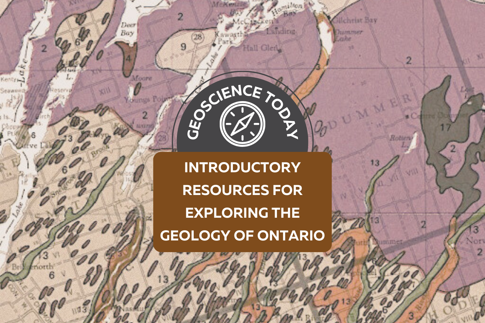
A geologic map showing different coloured rock units. Text over the map reads: "Geoscience Today. Introductory Resources for Exploring the Geology of Ontario."

Introductory Resources for Exploring the Geology of Ontario

A note from APGOEF:  Today we are publishing something a bit different than our regular blog posts! It is our primary goal at APGOEF to educate and spread awareness about geoscience, so when Ken Lyon presented us with this comprehensive list of resources, we couldn’t resist sharing it with our readers. We hope you will find this compilation useful to your exploration of earth science. APGOEF does not take responsibility for the content of the resources provided, and cannot vouch for their validity. Preface The following is written by: Ken Lyon, MSc, P.Geo, kenlyongeo@gmail.com, Peterborough, ON The impetus for this compilation of over 50 publications and internet resources came from Laura Mancini of the Ontario Geological Survey. Laura reached out to me in 2021 in my capacity as Newsletter Editor of the Kawartha Rock and Fossil Club. She had been contacted by someone who was looking to explore the geology of Ontario, and wondered if the Kawartha club might have something to help. Laura’s question fit in with a list of resources that I had started compiling for rockhounds, field naturalists and other people who like these kinds of things. Perhaps now more than ever with climate change and related issues front-and-centre, we are coming to appreciate that geoscience is hugely significant and fun to learn about and explore. In compiling this list, I have tried to offer some guidance by assigning levels to the resources ranging from Level 1 for those who know nothing or little about geology to Level 3 for those who feel comfortable with basic concepts. Resources marked with a * are particularly recommended. I have included some of my favourite books that cost money and also many good resources that are free of charge. Level 3 and beyond takes you into the worlds of serious mineral, rock and fossil collectors and people who have taken college and university courses. This is not to say that you need formal study. I am constantly learning from members of the Kawartha and other clubs who are self-taught and know more about some topics than I ever will. This compilation is a work-in-progress and I have made some minor revisions since 2021. Hopefully, you will find a few “nuggets” of information to help you get out and have some fun. Amethyst rock from Thunder Bay area, ON. Photo: Ken Lyon Amethyst is a purple variety of quartz and the official gemstone of Ontario. The reddish-brown crystals on the left are amethyst crystals coated with the iron mineral, hematite. The length of the rock shown is 40 cm. My wife bought this as a treasured addition to her rock garden. Acknowledgements While I take responsibility for selection of the resource list and comments, I would like to gratefully acknowledge review comments and encouragement provided by the following in alphabetical order: Andy Fyon, PhD, formerly of the Ontario Geological Survey; Kevin Kidd of the Kawartha Rock and Fossil Club and the Gem and Mineral Club of Scarborough; Laura Mancini, MSc, PGeo, of the Ontario Geological Survey; Bill Pearson, PhD, PGeo, and Deana Schwarz, PhD, PGeo, of the APGO Education Foundation; and Ashley Pollock of the London Gem, Mineral and Fossil Society, the Walker Mineralogical Club, and the Central Canadian Federation of Mineralogical Societies (CCFMS) Some Important Precautions and Disclaimers You are responsible for knowing where you can go, where you can park, what safety hazards may exist and what personal protective equipment you need, and what you can pick up and take back home. Parking rules change from road to road and place to place.  Respect all laws and rights governing private and Crown property, and obey all rules and regulations covering any access to and from any of locations. Bedrock outcrops and other locations can pose traffic, slip-trip-fall and other hazards. The use of hammers can be dangerous and in some cases destroys the outcrop for future observation. Rock, mineral and fossil samples cannot be removed from protected areas such as parks and conservation areas or from private property without permission. If you are rockhounding, please follow the CCFMS Code of Ethics for Rockhounds (https://ccfms.ca/Copied_Field_Trips.php) and Safety for Field Trippers (https://ccfms.ca/CCFMS-Safety-Rules.php). I have not personally visited most of the sites listed and cannot vouch for the accuracy of the content of the resources. And finally, I have to disclaim any liability in connection with the use of the information presented and my annotated comments and recommendations. Great Unconformity bedrock outcrop at Galesburg just northeast of Peterborough in The Land Between. Photo: Ken Lyon Paleozoic Ordovician limestone about 450 million years old overlying Precambrian granitic mountain core about 1 billion years old; incredible time spans. Annotated List Alphabetically by Author (or source when no author is available) Resources marked * are particularly recommended. Level 1 Resources Brachiopod and bryozoa fossils in limestone near Lindsay, ON. Photo: Don McLeod used with permission. Don maintains a good nature blog at https://www.donaldmcleod.com Fossiliferous Ordovician limestone about 450 million years old. At the time we were under a warm shallow sea south of the equator. The large fossil is about 3 cm across. Other Museums, Science Centres, Geo-Parks There are many museums and other facilities across southern Ontario that feature geology exhibits. Here are a few that were recommended by my reviewers: Arkona Lions Museum –  Arkona, ON Bancroft Mineral and Mining Museum, Bancroft, ON Canadian Museum of Nature, Ottawa, ON Hooper Virtual Natural History Museum – Carleton University, Ottawa, ON Metcalfe Geoheritage Park – Almonte  Miller Museum of Geology, Queens University, Kingston, ON Oil Museum of Canada, Oil Springs, ON Science North – Sudbury, ON Additional Fossil Resources Some additional fossil references recommended by my reviewers are listed below: Level 2 Resources Physiographic features of the Peterborough – Stoney Lake, ON area. Small portion of Physiography of the South Central Portion of Southern Ontario. Ont. Dept. of Mines and Northern Affairs, Map 2226. Scale 1:253,440. © Queen’s Printer for Ontario 1972. Reprinted 1984 with minor revisions. Features shown include till moraine (purple), sand plains

Read More »
Aerial view of a landscape with rolling hills, a valley, and a river. On top of the photo text reads: "Geo Careers. Mary-Anne Hildebrandt." with the icon of a pickaxe hitting a rock.

Geo Careers: Mary-Anne Hildebrandt

What is a career? Merriam-Webster defines career as “a profession for which one trains, and which is undertaken as a permanent calling.” With more workplaces embracing the idea of flexibility, the weight of words like “permanent” and “calling” evoke something else entirely. Career originates from the Latin carrus, as in a wheeled cart, which some interpret to mean chariot (Online Etymology Dictionary, n.d.). It sounds a great deal more epic than logging into a laptop for another Zoom call. Imagine you and your coworkers embarking on a journey in chariots each day. Surely, with that as your vision, nothing is out of reach. So, what do you do for a living? It’s a common question for any social gathering, and yet, my answer is met with surprise. People are surprised to learn that I am not a teacher or nurse or some other career that matches their perception of who I am. No one has ever guessed that I am a geoscientist. Why? Do I not look or sound like a geologist? This encounter is not exclusive to the public. In truth, I’ve even been mistaken for an administrative assistant when standing in my office wearing head to toe safety gear surrounded by rock samples, and that’s not to say administration staff don’t do field work. They most certainly can and do! It’s that everyone carries bias, and when no other information is available, we fill in the missing data with assumptions based on our own perceptions of the world. Even recently at PDAC, I was asked if I was there as a member of the media, and not a geologist. Who knew that you could work in an industry for 17 years and still feel at times that you don’t quite fit other people’s perceptions of your job title. Every day there are lessons, and some are only learned much later.  When I left university for my first summer field position in 2006, I intended to return for a Master of Science, but looming student debt and other family obligations drove me to stay in the industry. I dreamed about continuing to hone my skills in the areas of geoscience that I enjoyed. Early on, I had a conversation with a manager of a team I wanted to join about my career aspirations, and he tried to put an end to those dreams. He explained that no company would invest their finite resources to support my development in this field because I was a woman, and at the age of 25, I was too old. In his experience, it wouldn’t be long before I would marry, have children, and pursue a different career. I left that conversation feeling devastated because this manager was someone that I truly respected. At the time, I didn’t know how to challenge the underlying beliefs and assumptions that he had conveyed about me. I questioned whether saying anything at all would make a difference. Who was he to decide what my future would hold? That evening, I resolved to not let his ignorance define me.   Did you stay in Geoscience? I have had the good fortune to have worked in the field of geoscience since graduating and successfully achieved my designation as a Professional Geoscientist (P.Geo.) in 2017. Drilling, sampling, mapping, and modelling led me to a deeper understanding of the influence of geological processes, sample bias, and error within spatial models and mineral estimates. In addition, the depth and breadth of the technical projects I have been able to work on has increased not only my technical skills but also my leadership skills. After working for several years as the person performing the annual reconciliation for Mineral Resources and co-authoring the technical report on the resource, I was appointed to carry out the duties of Competent Person (as defined in the SAMREC and the JORC codes) for the deposit I had spent years mapping and modelling. A Competent Person is responsible for preparing the technical report used for public disclosure of a Mineral Resource and Reserve. In the Canadian context, a CP would be similar to a Qualified Person or QP under the National Instrument 43-101 Standard. CPs, like QPs, are considered to be competent to sign-off because they meet or exceed the knowledge requirements and have enough time working in a particular commodity, like gold. There are other requirements, and for those working in the industry, it is best to be well-versed in the governing code or standard for your jurisdiction. It’s an incredibly important responsibility that cannot be taken lightly, and I was honoured to know that those in power trusted my capabilities to appoint me into that role. Although I enjoy the technical aspects of my work, I have found mentoring and coaching others to be equally, if not more, rewarding. My career has carried me to remote areas across Canada and even overseas to Botswana and South Africa. I am forever grateful to have been mentored and supervised by professionals who are highly respected in their field. These are the people who saw the value I could add to a team and a project, and they were instrumental in why I stayed the course. I found professionals from all disciplines were always there to lend a hand or an ear to help find a solution to the latest problem.  One project that I had been assigned was to create a spatial estimate for a stockpile. This was not the norm and fell outside of our regular workflow. A stockpile is not an in-situ deposit. To use it in a business plan, my work still needed to answer similar questions that would be asked during mineral classification of an in-situ deposit. There are a number of factors involved in this work, but to keep this brief, these are the types of questions that needed to be considered: How did the mining team place the rock? Do we have confidence in the volume of the stockpile? How was the volume measured? At what frequency was the volume measured? Do

Read More »
Underground photo of a mine site. Tools and various machines sit in front of a wall covered in wire. Text on top of the photo says: Geo Careers Melissa Ng.

Geo Careers: Melissa Ng

One question that I often am asked is, “How did you pick mining as an industry?” That answer is simple: De Beers commissioned a raw diamond exhibit at the University of Alberta where I attended school. This was my first introduction to mining and the idea and complexity around mining, which I found fascinating and challenging. The second question I always get asked is: “How did you get to where you are now?” That answer is a little more complex. We all take different journeys in life and career. Some experiences are within our control, and some are not. People always joke: “If I knew what I knew now, things would be different.” But there is no journey, no growth, and no success without those experiences. They are unique to us and mold us in the unique individual we are. So, to me, the real question should be “How has your experience specific to your career helped you to get to where you are now?” I began my first job search after graduation with enthusiasm, looking for the job opportunity that would launch my career. At the time, the market was hot with international opportunities, as well as Canadian prospects, which meant that I could be picky about the opportunities I pursued. I knew from my summer jobs doing exploration work in the Northwest Territories that I wanted a fly-in fly-out position at an operation and not field exploration work. My husband and I were married in 2007, right after my graduation, so choosing a fly-in fly-out role was a lifestyle choice we were making so that we could stay in Edmonton. My parents were born and raised in Saskatoon, SK so I knew about Cameco Corporation, the uranium producer centered in Saskatchewan. I was excited to have an interview with them. Even during the interview, being able to talk about structurally driven deposits was thrilling. I felt good after the interview, and therefore, was disappointed when I later received a call that hiring had been frozen due to unknown circumstances. Lucky for Cameco, I was so picky during my job search that I had only applied to one other company at the time. In January 2008, I received a call asking if I was still interested and if I could start next week. I didn’t even own a pair of steel toe boots yet, so I couldn’t start the following week, but I was thrilled that I did not have to endure a second round of interviews. The first time I flew into Rabbit Lake operation, which is situated at the edge of the Athabasca Basin in Northern Saskatchewan, I felt what I would describe as contained excitement. Contained because I didn’t want to make it obvious how “green” I really was. In other words, I did not want to stand out or get noticed. Which is very hard to do when you are a woman in a male-dominated industry, and in particular, a young woman in a male-dominated industry. I stuck out like a sore thumb, despite my cargo pants and winter coat. I was fresh meat, and everyone wanted to get to know the new girl. Throughout my career, I have heard stories of women who feel like they made the wrong career choice and have left the industry. When I hear this, I reflect back to those first few days at Cameco. My first room at camp was not my permanent room and there was a nasty draft from the window blowing over my head. I remember wearing my toque and not being able to fall asleep, wondering what I had gotten myself into. After a few days, I moved rooms and, luckily, there was no draft in the second room. I remember sitting around the lunch table with the geologists and engineers and hearing the story about why my hiring was delayed. There was an open historical drilled lake hole that intersected a stope (a stope is a term in mining for dugout space that contains your ore that is to be mined). It was marked as cemented, but after the blast, water started pouring into the mine – a sign you never want to see underground. But the tale was dramatic and heroic, and through teamwork the workers were able to control the situation and mitigate the water. The epic conclusion of the story involved a geologist shoving a piece of PVC pipe into the hole on the shallow lake bottom. I know we all exaggerate our stories, but at that point, I knew this was my crew and this was where I belonged. This was 2008 and when the financial crisis hit hard I was fortunate to be at Cameco. Many of my colleagues from school found themselves without work whereas Cameco sold its product with contracts with locked-in pricing, which meant that Cameco was stable. And so was my career. That geologist who starred in the epic conclusion of the story with the PVC pipe was Dennis Merber, who was also my first mentor in the industry. Once he became the Chief Geologist at Cameco, I learned a lot from him. He gave us the flexibility to make the position our own. He recognized that you need to incorporate fun at work if you want to improve efficiency. He also encouraged sharing of job tasks, which is the primary reason why I was not just exclusively logging core at the start my career. His job as a leader was to take care of the wellbeing of his people and sometimes that was as simple as a break with a little bit of fun. His leadership tactic stayed with me my entire career and I have used it many times, even sometimes when I had to defend my decision to add fun to the work cycle. I stayed with Cameco for 8 years because of the people. I built many great relationships over that time, relationships that I keep to this day.

Read More »
Northern Ontario landscape with text: "Geoscience Today. The significance of Ontario's Ring of Fire to Canada's Climate goals."

The Significance of Ontario’s Ring of Fire to Canada’s Climate Goals

When you hear the term “Ring of Fire,” you might think of Johnny Cash’s famous song by that name. Or, if you remember grade school geography, you might think of the Pacific Ring of Fire—an area of high volcanic activity that surrounds the Pacific Ocean like a ring. But you probably haven’t heard of the third use of the phrase—Ontario’s Ring of Fire. In Ontario, the Ring of Fire is an area of 5000 square kilometres located approximately 400km north of Thunder Bay where there are significant mineral deposits. It’s called the Ring of Fire for two reasons. #1: If you look at a magnetic map of the area, there is a clearly delineated arc of responses. And #2: The founder of Noront, the mining company who first discovered the minerals in the area, was a huge fan of Johnny Cash. The Ring of Fire is made up of shared lands governed by 9 different First Nations. In recent news, the Ring of Fire has come to public attention due to concern from First Nations communities who are opposing the development of mines in the area and criticizing the government’s insufficient involvement with Indigenous communities in decision making processes. Let’s take a step back and look at why the Ring of Fire is geologically and environmentally important. Geologically, the Ring of Fire is an arcuate belt of Archean (approx. 2,750 MA) mafic and ultramafic rocks surrounding an intrusion of granodiorite. Based on exploration to date, the area is rich in deposits of important metals such as nickel, chromium, copper, zinc, and platinum. Since the Ring of Fire’s mineral deposits were discovered in 2007, mining companies have been eager to start developing mines in the area. Some of these deposits would likely be amenable to profitable underground mining (e.g., Noront’s Eagle’s Nest), but most of the chromite deposits discovered to date would require open-pit mining to extract them. There have been estimates of the total in-situ value of the Ring of Fire deposits ranging from $30 billion to $60 billion. However, the investment and costs required to extract them may reach similar levels, such that the actual economics of mining some of these minerals in the area remain to be established. Ecologically, the Ring of Fire is situated in the Hudson Bay Lowlands, which is the largest peatland in North America. Peatlands are waterlogged ecosystems where organic matter never fully decomposes, leading to the buildup of peat. This means that peatlands store large amounts of carbon from partially decomposed organic matter. The peatlands also absorb carbon dioxide from the air, acting as a filter for CO2. Peatlands are therefore important in storing and retaining carbon to mitigate the effects of climate change. As several Indigenous Chiefs have noted, disturbing these peatlands would release their stored carbon dioxide into the atmosphere. Since carbon dioxide is a greenhouse gas, the release of CO2 would go against the promises made by the Canadian Government at the Paris Accord to mitigate climate change. The potential impacts upon the environment from mining in the Ring of Fire are substantial, particularly if it was proposed to extract chromite (the chromium mineral) by open-pit methods. Not only would that process disturb the peatlands, potentially releasing stored carbon from the peatlands, but surface disposal of mine waste and tailings would (at least in part) be deposited on top of the peat. Indigenous communities have also emphasized the potential negative impacts on surface and groundwater from mining, as several First Nations live directly downstream from the Ring of Fire and would be negatively affected by any toxic runoff or damage to the rivers. The Canadian and Provincial governments have made a goal to invest in the production of electric cars to decrease Canada’s emissions from gas- and diesel-powered engines. The mineral deposits in the Ring of Fire contain nickel and copper, essential minerals for building electric car batteries. In March 2022 the Provincial government released a plan to build electric cars from start to finish in Ontario and has stated that this would require minerals to be mined in Ontario as a first step along the production line. Ontario already produces both nickel and copper from existing mines in the province, so new developments in the Ring of Fire would be complementary to those currently operating and could add significantly to the resources available for incorporation in electric vehicles as their production is ramped up over the next few years. Opening mines in the Ring of Fire could be a great boost for Ontario’s economy, as they would generate many job opportunities for local communities. Several of the communities surrounding the Ring of Fire are not currently accessible by road, so building infrastructure to support the mines would connect these communities to Ontario’s provincial highway system and allow electricity to be delivered by powerlines rather than diesel generators, thus reducing the carbon footprint of those communities. There are many different factors to consider when deciding whether mining developments in the Ring of Fire should go forward. Included amongst these is weighing the cost of releasing carbon dioxide into the atmosphere with the potential decrease of released carbon from electric vehicles. Additionally, the potential impact on the watershed or the increase in jobs for First Nation communities should be considered. These factors are some of the issues that comprehensive Environmental Assessments are designed to evaluate thoroughly. One of the major considerations in any new mining development proposal is the duty to consult and engage with local and affected communities. In this case there is strong opposition from some local Indigenous communities. In early January 2021, groups from the 9 affected First Nation communities met with the Minister of Environment and Climate Change Steven Guilbeault to discuss the upcoming Regional Impact Assessment that is planned for the area. The goal of the RIA is to quantify the extent of the ecological impact of mining on the Ring of Fire. Soon after the meeting, chiefs from Attawapiskat, Eabametoong, Kashechewan Cree, Fort Albany, and Neskantaga

Read More »