A hiker stands on the top of an outcrop looking over a distant mountain scene. Text reads: "Beneath Your Feet. A geoscience podcast."

PODCAST EPISODE #6: From Extraction to Innovation with Mary-Anne Hildebrandt

Summary In episode 6 of Beneath Your Feet, A Geoscience Podcast, host Veronica Klassen interviews resource geologist Mary-Anne Hildebrandt. Mary-Anne discusses her roundabout path to geoscience, unique career journey, and focus on sustainability throughout her career. Mary-Anne and Veronica discuss the perception of geoscience as a ‘fluffy’ science and how including geoscientists in conversation can benefit organizations. Mary-Anne provides insight into the role of geoscience in moving from a linear to a circular economy and how understanding the energy and value of a consumable good can help us to waste less. Listen now: You can also listen to our podcast on these platforms: Spotify Audible Apple Podcasts Read along with the podcast transcript: Introduction Hello, everyone. Welcome to Beneath Your Feet, a geoscience podcast. I’m Veronica Klassen, science communicator, geology enthusiast and your host. Here at the APGO Education Foundation, our mission is to spark curiosity and passion for the geology of Ontario. Whether you’re a geology nerd, science enthusiast, or nature lover, this podcast is for you. Join us as we geek out over fascinating geology, uncover the hidden storiesand secrets of our extraordinary planet and explore the captivating world beneath your feet. Veronica Klassen: Hello everyone and welcome to another episode! Today I’m going to be talking to Mary-Anne Hildebrandt, a resource geologist and past president of PGO. Mary-Anne has a BSc in Geological and Earth Sciences, a BA in Political Studies, and a Master of Earth and Energy Resource Leadership, where she did her thesis in waste and the circular economy. So we’ll be discussing the perception of geoscience in society, advice for young students, how to choose what to study, and the role of geoscience in moving away from increasing waste and towards a circular economy. Welcome Mary-Anne. Thanks so much for being with me. Why don’t you start by telling us a bit about yourself? Mary-Anne Hildebrandt: So, Veronica, it’s so great to be here today. I’m a resource geology manager at Stellar Gold. And what that means is that we’re creating the three dimensional models and estimates that will be used for potentially the development into a mining project down the road. We’re a junior exploration company. A bit about myself I studied at Queen’s quite a long time ago now. I’ve been in the industry for, I guess, 17 years, it seems like it’s gone by in a flash, but it’s been a lot of different fun opportunities over the course of that time. So you know, I started in exploration, was in production, mining, environment for quite a number of years, almost ten years. And I’m back at exploration again. Veronica: Amazing. Thanks so much. You’ve been doing so many different things. I think that’s that’s awesome. So with that, if you’re talking to students who are maybe considering going into geoscience or who are just deciding what they do want to study or what they want to go into and consider as their career options. What would be the best piece of advice you would have for students trying to figure out what they want to do? Mary-Anne: I think with geoscience, like there’s so many different pathways to doing because geoscience is used in in many ways people don’t even realize. Right? Field based part is probably the most visible. But then there’s also the regulatory space with geoscientists working within government and other conservation authorities that are doing work to protect the public. And then there’s the Bay Street Geoscientists, and they could be analysts that are giving advice to investors. Right. And same on the security side, geoscientists that sit within securities, again, a city based position that is that’s creating protection for investors on the stock market. And there’s just so many different ways you can do geoscience. And it’s it’s incredible really, how many opportunities there are. If that answers your question. Veronica: Yes, no it does. And I think that there are so many different ways that you can do geoscience and people might not consider that as students. I guess as like as student would you recommend them like looking into like a wide variety of options or just like starting kind of with the basics and going from there, or how would you recommend them sort of like approaching that? Mary-Anne: I think as students, you know, there are sort of two ways to go about being a student, right? You’re either a student that knows exactly where they’re going, and I don’t know how many students really are those people. And then there’s the students that, you know, might start their university career in one direction and choose something else. I’m one of those students myself. I actually started my first degree, my first major was in political science. It wasn’t in geoscience. And it’s not because I didn’t appreciate geoscience. I didn’t really know much about it where I came from. You’re either a doctor or a lawyer or a teacher or a nurse. That was the things that are my career counselors talked to our high school students about. And I happened to have been always curious about rocks and nature and whatnot and, and the intersection of society and, you know, the natural environment. And because of that, I had more and more of my projects in my first major were geared with an underlying sort of conversation around society’s obligations regarding the natural environment. And, you know, I had been chatting with my closer friends and they were like, why don’t you take a geoscience course as an elective? And that’s what I did. And it was out of that elective that I realized I really liked that discipline. I felt like I was home. And it was the professor of that course that contacted me amongst a group of other folks over the summertime and said, why don’t you come back to the university and do a degree in geoscience? That was Dr Jean Hutchinson that did
Read More »
A hiker stands on the top of an outcrop looking over a distant mountain scene. Text reads: "Beneath Your Feet. A geoscience podcast."

PODCAST EPISODE #4: Reefs and Reels: Evolution and Communication with Charlotte Spruzen

Summary In this episode of Beneath Your Feet, A Geoscience Podcast, host Veronica Klassen interviews Charlotte Spruzen about her research on ancient reef systems in the Yukon and their role in the evolution of complex life. Charlotte explains how these ancient ecosystems provide clues about early animal life and Earth’s changing environments. Beyond her fieldwork, she shares insights on geoscience communication, including her experiences making educational TikTok videos and the challenges of debunking misinformation online. The conversation highlights the importance of making science accessible, engaging, and accurate in a digital age where myths can spread quickly. Listen now: You can also listen to our podcast on these platforms: Spotify Apple Podcasts Amazon Music Audible Read along with the podcast transcript: Introduction Hello, everyone. Welcome to Beneath Your Feet, A Geoscience Podcast. I’m Veronica Klassen, science communicator, geology enthusiast and your host. Here at the APGO Education Foundation, our mission is to spark curiosity and passion for the geology of Ontario. Whether you’re a geology nerd, science enthusiast, or nature lover, this podcast is for you. Join us as we geek out over fascinating geology, uncover the hidden stories and secrets of our extraordinary planet and explore the captivating world beneath your feet. Veronica Klassen Welcome. Thanks so much for being with me here today. Today I’m going to be talking to Charlotte Spruzen, who is a PhD candidate at McGill University, studying the evolution of complex life. So, thanks for being with me here today. Charlotte Spruzen Thank you for inviting me, I’m so excited to be here. Veronica So, yeah, why don’t we just start with, tell us a little bit about yourself, who are you and what do you do? Charlotte Yeah. So I’m Charlotte. My pronouns are she/ her. I came to Canada three years ago, so I’ve been in Montreal since then, working at McGill University. I’m a PhD candidate in sedimentology and stratigraphy. So that’s basically looking at sedimentary rocks and seeing how they change as a function of distance from the shoreline and how sea level changes as well. And before that, I was in the UK, as you can probably tell from the accent. I love it, I love Canada, I love being here. I am really into my research and yep, that’s a little bit about me. Veronica Amazing. Thanks so much. Yeah. And I found you via your TikTok channel, which is really fun. And so you also do a little bit of science communication there, which is also a really cool part of what you do. Charlotte Yeah. I keep forgetting to plug that. Yeah. So I do a bit of science communication under the username @charbonate. And I do that on Instagram and TikTok it’s the same content on both and I make videos about mostly sedimentary rocks but I’m moving a little bit more into climate change just because I feel that’s important in the current political landscape. Veronica Yeah, that is definitely very important. All right. So with your studies, what what is it day in life look like for you both when you’re out doing research in the field or when you’re at home at the university? Charlotte So my time, as you kind of alluded to, is split between fieldwork, which is maybe like 1 or 2 months per year and office work. So when I’m in the field, it sort of depends on where we are. But most of my fieldwork has been in Yukon, so that’s helicopter fieldwork out in the Ogilvie Mountains just north of Dawson City. It’s an absolutely beautiful part of the world and I’m so lucky to work there. And a day in the life there, we’ll be staying in like individual tents. So we will have slept in the tent overnight. You wake up, you go into a group tent, you make coffee, you make breakfast, which is normally just oatmeal with just the same thing every single day. It gets pretty boring. And then we leave at, you know, between 8 and 9 a.m. and we go out into the field and we do between an eight and a ten hour day. And we’re walking off to the outcrops and we’re studying the rocks, mostly taking what are called stratigraphic logs. So that’s when you walk up a hill and you’re measuring how the rocks change through time. Well, how the rocks change up the hill, which means how they’re changing through time. And then we come back, we make our dinner, which again, is pretty much the same thing every day. It’s just a dehydrated meal and you add hot water. And so we have that. We have maybe some like, fun snacks and then we go to bed. So, yeah, it’s very much the same routine, but different rocks every day, which is pretty cool. Veronica Hm, that’s awesome, yeah. Charlotte And then when I’m in the office, again, there’s like a lot of, so I guess kind of the opposite of the fieldwork where there’s a lot of variety. I’m kind of doing something different every day. So sometimes I might be doing some lab work measuring the geochemical composition of things. Sometimes I might be writing or maybe doing some coding, figure plotting, basically preparing things for manuscripts or for my thesis. And then other days I’d say most days right now I’m doing microscope work. So my main area of interest is looking at really thin slices of carbonate rocks and trying to figure out if they’re getting more complex through time. So I’m just spending hours staring down the microscope looking at these tiny little like micron scale features, which I love, but it does give you a headache after a little bit. Veronica I believe it. Okay, awesome. That’s super cool. I love that, there’s so much variety in what you do. I think that’s really fun. How did you get where you are? Like, how were you originally

Read More »
A hiker stands on the top of an outcrop looking over a distant mountain scene. Text reads: "Beneath Your Feet. A geoscience podcast."

PODCAST EPISODE 3: From Books to Bedrock: Student life with Keira Hum

In this episode, we sit down with Keira Hum, a passionate Integrated Science student at McMaster University, to explore the ins and outs of student life in the world of Earth Sciences. Keira shares her journey from the classroom to the field, offering invaluable advice for balancing academics, personal growth, and career aspirations. Whether it’s navigating coursework, finding opportunities in the geoscience community, or preparing for a future in the field, Keira’s relatable stories and practical tips are sure to inspire students and geoscience enthusiasts alike. Tune in for a fun and insightful conversation packed with guidance for thriving in geoscience studies! 🌍🎙️ Listen now: You can also listen to our podcast on these platforms: Audible Apple Podcasts Spotify Read along with the podcast transcript: Introduction Hello, everyone. Welcome to Beneath Your Feet, a geoscience podcast. I’m Veronica Klassen, science communicator, geology enthusiast and your host. Here at the APGO Education Foundation, our mission is to spark curiosity and passion for the geology of Ontario. Whether you’re a geology nerd, science enthusiast, or nature lover, this podcast is for you. Join us as we geek out over fascinating geology, uncover the hidden storiesand secrets of our extraordinary planet and explore the captivating world beneath your feet. Veronica Klassen Thanks so much for joining me. Today I’m here with Keira Hum, a third year university student at McMaster. We’re going to be talking about some tips and ideas for being in school, studying geology,all those sorts of things. And I think it’ll be a really good conversation. I’m really excited to talk with you. Keira Hum I’m really excited to talk to you, too, Veronica. I’m excited to kind of talk about my job and experience going through a geoscience program. VeronicaYeah, for sure. All right, so why don’t you just start by introducing yourself? Who are you? What do you do? KeiraSo, yeah, my name is Keria Hum. I go to McMaster, and I’m in the Integrated Science program. I’m going into my fourth year of study and I have a concentration in Earth and Environmental Science. So I do a lot of, like, scientific research and take a lot of environmental electives. VeronicaAwesome. How does it feel being almost done? KeiraPretty good. I know I’m going to miss my friends a lot so that I’ll be going over my mind throughout the year and kind of thinking about master’s programs too, right now. So that’s been what I’ve been doing. VeronicaYeah. And how did you get where you are now? So how did you originally become interested in geoscience and what was that journey like for you? KeiraSo in my first year of undergrad in my Integrated Science program, we did have an introductory lecture and course in Earth and Environmental Science, and I really enjoyed that compared to like all the other courses that we had to take. And I just thought the Earth Science course was so much more fun and so much more interactive. And I also took an intro to Environment, Climate and Water, and I thought that was really interesting too. And I had a bunch of field events, which was really fun, and I thought, you know, can’t hurt to try going into that concentration. And I’m so glad that I did. VeronicaYeah, that’s awesome. And I think I remember you saying that you were not imagining that you would do Earth Science before university. You had a different track in mind. Is that the case? KeiraYeah. I was thinking I would go into biology. That’s kind of what I was interested in during high school. But getting introduced to the course at a university level and the concepts I thought was really interesting. I really like the idea of sitting in the classroom, learning about the concepts and then doing labs outside and in the field. That was really interesting to me and I learn so much better in those kind of environments. So it was kind of perfect for me. Yeah, and I just thought, it’s so applicable to so many different types of disciplines, like I could do biology and geoscience if I wanted, or earth and environmental science and biology. And I really liked how the discipline can, kind of, interact with so many other ones. VeronicaYeah, definitely. That’s one of the things that I also love about geology is just like how universal is and like it relates to so many different scientific and also nonscientific areas of study. KeiraYeah, for sure. VeronicaAnd you also said that you decided to try to get your PGO certification. So could you tell us a bit about how that process has been for you? KeiraYeah. So I first got introduced to what PGO is and the importance of it in my first year of study. So I was kind of thinking about it and trying to plan my courses for the PGO and because I’m in ISci, it’s hard to manage my electives just because I have limited space every year. So I had to do a lot of planning field courses and extra courses during the summer and spring terms just so I can make up all the knowledge requirements to get the PGO certificate. So it’s been a lot of planning and stress, but I know it’ll be worth it in the end. Yeah, I love the courses that I’m taking anyway that are required for the PGO knowledge requirements, so I find it, you know, not too difficult and pretty enjoyable because I’m getting more exposure to courses I might not have noticed or taken if it wasn’t for the PGO requirement list and seeing the course offerings on that document. VeronicaRight? Yeah, it’s different things that necessarily you would always get to get to explore. So that’s cool. On that note, do you have any other piece of advice that you would give for younger students who are maybe considering PGO or geoscience in general? What

Read More »
Text reads: Geoscience Today. Geoscience meets AI: Imagining tomorrow's possibilities.

Geoscience Meets AI: Imagining Tomorrow’s Possibilities

Mary-Anne Hildebrandt, P. Geo., FGC Energy and minerals power our lives, and while we Canadians live in a land of abundance, global projections of natural resource consumption far exceed what is readily available. Economic geologists are increasingly challenged to locate near-surface mineral resources that are feasible to extract. Today’s evolving business models focus on creating more precise, surgical methods of extraction, not only to reduce the environmental impact of mining, but also to unlock economic potential in deposits that, in the past, would not have met the threshold for Reasonable Prospects for Eventual Economic Extraction (RPEEE). In parallel, we are working in the era of Big Data. In 2020, NASA reported that its Earth Science data collection had reached 40 petabytes (PB), a unit 1000 times the size of a terabyte (TB) and that this collection was expected to expand to 250 PB within six years. Geoscience data in the mineral and mining industry follows a similar trend. Big data and increased complexity of the deposits make it essential that Professional Geoscientists (P. Geos) leverage Artificial Intelligence (AI) because traditional methods of analysis are often insufficient to handle the scale and complexity of modern datasets. There are many companies and software developers trying to deliver solutions that produce high-quality results in real-time such as geochemistry, mineralogy, and structural measurements collected and analyzed in real-time at a drill rig using either powerful downhole tools or field core scanners. Some experts in the field believe that these advancements may reduce the necessity for geoscience professionals; however, it is far more likely that AI will strengthen our ability to understand, analyze, and model vast amounts of data, giving us insights that would otherwise be unattainable in a short amount of time. Consider society’s approach to earthquakes and how advanced we have become in creating predictive models over the last century. There are AI applications in use today that allow P. Geos the ability to analyze large datasets that aid in the creation of robust, predictive models. These detailed models allow P. Geos to have a better understanding of risk to the public and offer greater guidance to inform early warning systems. By integrating AI into our professional toolkit, we will be able to make more informed decisions, streamline complex analyses, and better allocate limited resources.  Professional regulators, such as Professional Geoscientists Ontario (PGO), also stand to benefit from AI. For example, AI could be used to identify patterns and anomalies that would allow regulators to detect unethical behaviour more effectively. Rather than waiting for another Bre-X-type incident, where a company reported falsified assay results that inflated the gold reserves to attract investors, it is in the public’s best interest for our profession—and its regulators—to develop advanced tools to stay ahead. It is certain that bad actors will also leverage AI to attempt to bypass existing legal frameworks, making it essential to reinforce our defences. However, as powerful as AI is, its use must be carefully guided. As a profession, we bear the responsibility to harness AI in ways that ensure its development and applications remain ethical, transparent, and fair. We need greater dialogue and a robust framework to guide this evolving area. Inherently, AI lacks an understanding of ethical intentions. It makes decisions based on the algorithms and code designed by humans, as well as the dataset on which it is trained. However, developers have the ability to instil AI with ethical or unethical subroutines either intentionally or unintentionally. Developers might choose to design it with an underlying malicious intent, such as spreading misinformation, or creating harmful automated decisions that negatively affect individuals, groups, or the natural world. Unintentional biases could also emerge if the AI is trained on a limited or biased dataset, leading to skewed decisions or outputs. For example, a mining company using AI to identify mineral exploration targets might train the system on a flawed dataset that lacks sufficient diversity in the geological dataset used for training. As a result, the AI could misunderstand key aspects of the mineralization controls if its training dataset is incomplete or biased. This could lead to the AI relying on surface-level features like rock type or mineral traces that resemble those found in resource-rich areas. However, without accounting for other critical factors such as depth, geological history, geochemistry, alteration, or other favourable conditions needed for mineral formation, the AI might incorrectly predict the presence of valuable deposits in barren areas. This misinterpretation could lead to the company and its shareholders to invest millions in unproductive exploration, wasting time and money. Meanwhile, the AI might overlook other areas with better prospects due to the skewed training dataset. Without the critical and well-trained eye of a P. Geo. guiding AI and validating its outputs, AI has the potential to cause not only financial losses, but also unnecessary environmental damage. PGO’s Code of Ethics calls on P. Geos to demonstrate “integrity, competence and devotion to service and to the advancement of human welfare”, and it is imperative that AI systems embody these principles as part of the original code. Responsible integration of AI is critical to upholding the public’s trust in our profession, and a balanced approach is needed to ensure that we seize opportunities while safeguarding the public and the natural world from harm. After using the wrong ingredients to bake a cake, Anne Shirley reflects “…isn’t it nice to think that tomorrow is a new day with no mistakes in it yet?” (Anne of Green Gables, Ch. 21, by L. M. Montgomery). In the age of AI, geoscientists must remain committed to continuous learning and ethical practice. AI will inevitably become more integrated in our daily activities. To ensure that AI has the right ingredients that will prevent harm to society or the natural environment, we need greater discussion and more collaboration with each other and our peers in data science to build a framework that guides the use of AI in geoscience practice. A proactive approach focusing on the development of an

Read More »
Text reads: Geoscience Today. Pukaskwa National Park: A geological gem in the northern ontario landscape.

Pukaskwa National Park: A Geological Gem in the Northern Ontario Landscape

Author: Cyndy Broughton, Minerals Engineering Technologist The APGO Education Foundation is pleased to support the Geologist-in-Residence program at Pukaskwa National Park. Gazing out over the calm waters of Hattie Cove near the visitor centre at Pukaskwa National Park, I realized the allure of the park. Many of the people that I had recently met during my walks around the park were repeat visitors, coming back year after year to experience the wonders of nature. Some visitors travelled thousands of kilometers each year to experience the solitude and beauty that the park has to offer. Some came to relax and enjoy family time; others came to paddle the waters of Lake Superior or hike the many trails in the park. My goal that day was to help park visitors view the vistas of Pukaskwa through the lens of geology. In August 2024, I had the opportunity of being the Geologist-in-Residence at this beautiful national park located on the shores of Lake Superior near the community of Marathon, Ontario. My last visit to Pukaskwa National Park was in 1984 as a young geological technologist enjoying a day off from work and taking the opportunity to swim in the clear waters of Lake Superior. Now I was returning at the invitation of the Canadian Federation of Earth Sciences and Parks Canada near the end of a career spent mostly in geological education. The role of the Geologist-in-Residence (GIR) program is to highlight the significant geological evidence and history on display within the park and increase public awareness and appreciation of geoscience. The mandate of Parks Canada is to protect and present nationally significant examples of Canada’s natural heritage. Parks Canada’s goal, written in its vision statement, is to make Canada’s treasured natural and historic places a living legacy, connecting hearts and minds to a stronger, deeper understanding of the very essence of Canada. Two of the guiding principles that govern the system of national parks are Education and Presentation and Human-Environment Relationship. Successful natural interpretive programs allow park visitors to discover and learn about ecosystems. Sharing knowledge about sustainability and the connections between people and our environment are important tools in ensuring that our efforts to protect our natural heritage are successful. When we provide the opportunity to experience nature and we share knowledge of ecosystems, we can foster the desire in citizens to protect and appreciate the world around us. To understand the very essence of Canada, we need to share geoscience knowledge, as well as knowledge of wildlife and botany. The geology of our country is literally the ground beneath our feet. Knowledge of geology can help make connections to soil formation, biodiversity, water quality, mineral resources, energy resources, and so much more. The Geologist-in-Residence program is an important program that helps to develop interpretive geology hikes and drop-in sessions where visitors to the park are invited to engage in interactive, hands-on programs. Programming is developed by geoscience educators to help park staff share the geological wonders of the park. This year’s guided hike to Pukaskwa National Parks North Beach helped visitors travel back through geological time to explore the formation of the 2.7-billion-year-old rocks. We discussed the formation of the Lake Superior basin through mid-continent rifting 1 billion years ago and ended our hike examining the impact that glaciation had on the rocks and sand deposits along the coast. During drop-in sessions, we tested the chemistry of Lake Superior waters and connected our results to the geology of the Canadian Shield. Children had the chance to learn basic rock and mineral identification skills and were able to apply those skills when they explored the rocks on the hike. With the assistance of Parks Canada Interpretation Officer and Coordinator Carly Robillard, the support of the Canadian Federation of Earth Sciences (CFES), and the financial support of the APGO Education Foundation, my time spent at Pukaskwa National Park was a rewarding experience that offered me the opportunity to showcase the geological wonders of the park and help visitors make those important connections between geology and world around us. Cyndy Broughton is a Minerals Engineering Technologist and a Professor with 36 years of experience teaching geology and environmental science at Fleming College. She encourages everyone, young and old, to head outside and discover the connections between geology and the living world.

Read More »
A hiker stands on the top of an outcrop looking over a distant mountain scene. Text reads: "Beneath Your Feet. A geoscience podcast."

PODCAST EPISODE 2: Stories, Science and Society: Reframing Geoscience Communication with P.Geo. Paul Hubley

Join podcast host Veronica Klassen and guest Professional Geoscientist and CEO of Geoscientists Canada Paul Hubley in this discussion of geoscience communication and the future of geoscience. Hear from Paul on his career, life advice, and how we can start to create a more accurate perception of geoscience in society. Join us in discussing how Earth Science can help us wrestle with the big issues of our time, and the importance of relationship building, storytelling, and listening in addressing these issues. Episode Audio: You can also listen to our podcast on these platforms: Episode Transcript: Veronica Klassen Hello, everyone. Welcome to Beneath Your Feet, a geoscience podcast. I’m Veronica Klassen, science communicator, geology enthusiast and your host. Here at the APGO Education Foundation, our mission is to spark curiosity and passion for the geology of Ontario. Whether you’re a geology nerd, science enthusiast, or nature lover, this podcast is for you. Join us as we geek out over fascinating geology, uncover the hidden stories and secrets of our extraordinary planet, and explore the captivating world beneath your feet. Today I’m meeting with Paul Hubley, and we’re going to be talking a little bit about his career, we’re going to be talking about advice for students, the perception of geoscience in society and some other really cool things. So yeah, if you want to just do like a quick introduction to yourself, that would be great. Paul Hubley, P. Geo Fantastic. Thank you very much. Thanks for inviting me here today, I’m excited to be here. So, Paul Hubley, I’m a male in my in my 50s, born in Halifax, living with my wife, Caroline, and on any given day, between two and three of our five kids are living with us as. We also have a little chihuahua. And I’m a professional geoscientist. Before we go further, geoscience is a regulated profession, just like engineering. So I’m a P. Geo. I’ve been in environmental consulting for 35 years, and the vehicle that brought me there is an education in Earth Sciences. I’ve got a Bachelors of Science with Honours in Geological Sciences from Brock University and a Master’s of Science in Earth Science from the University of Waterloo. That was way back when, in 1995 before the turn of the century, turn of the millennium. Other than being a father and geoscientist, I’m a self described serial volunteer. Just to pick up skills and contribute in ways that work didn’t bring bring to me. I like to landscape and build things outside, as long as it doesn’t have to be too fancy, then count me in. I’m a measure once, cut twice, kind of person. So I like to dabble. And I found out recently I like to do some creative writing, so I’m a bit of a groundskeeper as well. Veronica Yeah. And you’ve been doing some creative writing for our blog, which has been very fun. So you can check out those articles on our website.  Paul Yeah, it’s more of a dabbler. So the groundskeeper is the landscaping and the creative writing is a bit of a dabbler. So yeah, I hope that people do check it out. Veronica Yeah. Yeah, for sure. All right. Thanks so much. Yeah. So tell us a little bit about how you first got interested in geoscience. Like what drew you to geology? Paul Well, I had always been drawn to the ocean. Being born in Halifax and going to Nova Scotia almost every year and summer, the ocean was just part of my life. And somewhere around grade 10 or 11, I was convinced that I wanted to be in the Coast Guard. It would take me to the East Coast that I loved, keep me on the water for my entire life. That’s what I was thinking and I thought I’d like to push myself, I like to travel, all those things. And for some reason I just got the feeling that that particular thing was going to be too limiting. And also the 1980s were the time of deep sea exploration. Jacques Cousteau was sending submarines down to deep sea vents and they were finding these black smokers in the bottom of the Mariana Trench and things like that. And I just thought, this is amazing stuff. So then I switched from the Coast Guard to wanting to be a marine biologist. I was absolutely convinced I was going to be a marine biologist until I took a Grade 13 biology class and felt it wasn’t connecting. It was just a lot of memorization and just technical terms I just wasn’t connecting with. And I also had the opportunity to take a geology class in high school, which is pretty rare. That was inspiring. So, at the same time, the biology bubble was deflating and the geology bubble was inflating. And I thought, wow, I decided that I really wanted to work on environmental issues. And this could be a vehicle to do it. And it is. It has been. And I never looked back. I don’t know where I got it in my head. I thought it was my idea and nobody else had this idea, but apparently I was wrong. There was a whole industry that was building up at the time, so I probably picked it up somewhere else, but I took it on as my own. Veronica That’s awesome. Yeah. So you’ve been on quite a journey. What’s your best piece of advice for young students and how how can they figure out, kind of, what they are interested in, what they want to do? Paul Yeah, ultimately the journey was convoluted and it was difficult and there’s a lot of choices and that can be difficult for people. I guess I could say a couple of things here. One is that what you choose, if you’re lucky enough to feel, it feels right like I was, then go for it, do it.

Read More »
A hiker stands on the top of an outcrop looking over a distant mountain scene. Text reads: "Beneath Your Feet. A geoscience podcast."

PODCAST EPISODE 1: Devonian Discoveries: Fossils at Wainfleet Wetlands with Paleontologist Dr. Daniel Dick

Join podcast host Veronica Klassen and guest paleontologist Dr. Daniel Dick as we delve into the creation of a GeoHike at Wainfleet Wetlands. Discover the unique ecosystem of the middle Devonian period through an array of fascinating features: encounter colonial organisms, massive corals, glacial striations, and pop-up structures. We’ll discuss potentially undiscovered fossils, augmented reality animations to bring fossilized animals to life, and what counting layers on rugose corals can tell us about the speed of the Earth’s rotation in the Devonian. Episode Audio: You can also listen to our podcast on these platforms: Episode Transcript: Dr. Daniel Dick (Dan) It looks like an ecosystem where the water was just drained out of it. It feels alive and it will really help you understand just how different the world used to be. I think that is the main thing that makes paleontology interesting. It just shows you that the world has changed so much, and it will blow your mind. [musical interlude] Veronica Klassen Hello, everyone. Welcome to Beneath Your Feet, a geoscience podcast. I’m Veronica Klassen, science communicator, geology enthusiast and your host. Here at the APGO Education Foundation, our mission is to spark curiosity and passion for the geology of Ontario. Whether you’re a geology nerd, science enthusiast, or nature lover, this podcast is for you. Join us as we geek out over fascinating geology, uncover the hidden stories and secrets of our extraordinary planet, and explore the captivating world beneath your feet. [musical interlude] Veronica All right, let’s get started. Today, I’m going to be talking to Daniel Dick, who is a researcher at McMaster University. Daniel, why don’t you start by telling us a bit about yourself? Dan Yeah, I mean, you covered quite a bit there. I’m Dan. I’m a postdoc at McMaster, primarily working on this public outreach project that we’ve been developing over the last few years. Which, in conjunction with the APGO Education Foundation, is developing this website, GeoscienceINFO, and primarily we are working on the GeoHikes. Research-wise, I’m a paleontologist. I focus primarily on fossils. I work on mass extinction events and trying to understand the dynamics of them, with the end goal of hopefully applying some of the knowledge we might learn from past extinction events to help us understand contemporary extinction dynamics and areas of risk and things like this. Yeah, so, my research sort of takes me all over. It’s primarily focused on Ordovician-Silurian fossils. So that’s a lot of stuff that we find here in Ontario, but also in other parts of Canada and the United States and such. Veronica Amazing. So how did you originally get interested in geoscience? Like, what led you here? Dan I’ve definitely been interested in it for a very long time. I have photos as a kid at the Royal Tyrrell Museum staring at the fossils, and you can sort of see that it’s already something I’m obsessed with at that point. But the beginning of the journey, I think, was in high school because my high school actually had Earth science courses up to grade 12 in B.C., where that’s sort of more standard. And I’d kind of forgotten how much I like geoscience, I think until those late courses. And it reminded me, oh yeah, I forgot that this was a thing. And that was something that I enjoyed and was good at as well, which helped. Veronica So, it was kind of high school, then you decided to study it in university. Did you go straight into geoscience? Dan Yeah, I didn’t actually go straight into it. I went into evolutionary anthropology, so I was focused more on human evolution and human fossils and things like that. But then found myself realizing that the questions and things I was more interested in could more easily be answered by working with non-human fossils, because you need large numbers of things, so you need lots of fossils in order to start to understand things like extinction dynamics and climate change and all that kind of stuff. And so, I switched over to more standard and invertebrate paleontology at that point for my Ph.D., which then looked at those kinds of questions. Veronica So, when you say those kinds of questions, you’re talking about extinction events and how we can learn from that? Is what you mean? Dan Yeah, absolutely. Yeah. Veronica Yeah, for sure. And just for a little bit more context do you want to explain kind of like what the GeoHikes are, what’s like the purpose of the GeoHikes? Dan For sure. So basically, like the GeoHikes are kind of a, they’re sort of a freely accessible trail guide in a literal sense, that’s what they are. They take you along an existing hiking trail that has some sort of geologically interesting features on it, and there’ll be a series of stops which will take you to these different features and will describe for a general audience what’s going on geologically. Occasionally we do other things beyond geology. We also look at ecology, for example, talk about invasive species or we’ll find fossils on some of the hikes, and we’ll talk about ancient ecosystems or mass extinctions or whatever it is we’re doing. And my personal vision for them, is I see them sort of as a living first year Earth science lecture. They’re simple in the sense that they should be understood by anyone. But instead of having a textbook figure or something explaining the process of erosion or soil formation or something, you go to a physical location where this is all on display. And so, the figure that you would normally look at in a textbook is now there in front of you in real life and offers an opportunity to learn this. Ideally, the way I see it is if you do enough of these GeoHikes, you will get all the basic information you would need to understand, you know, the sophistication of

Read More »
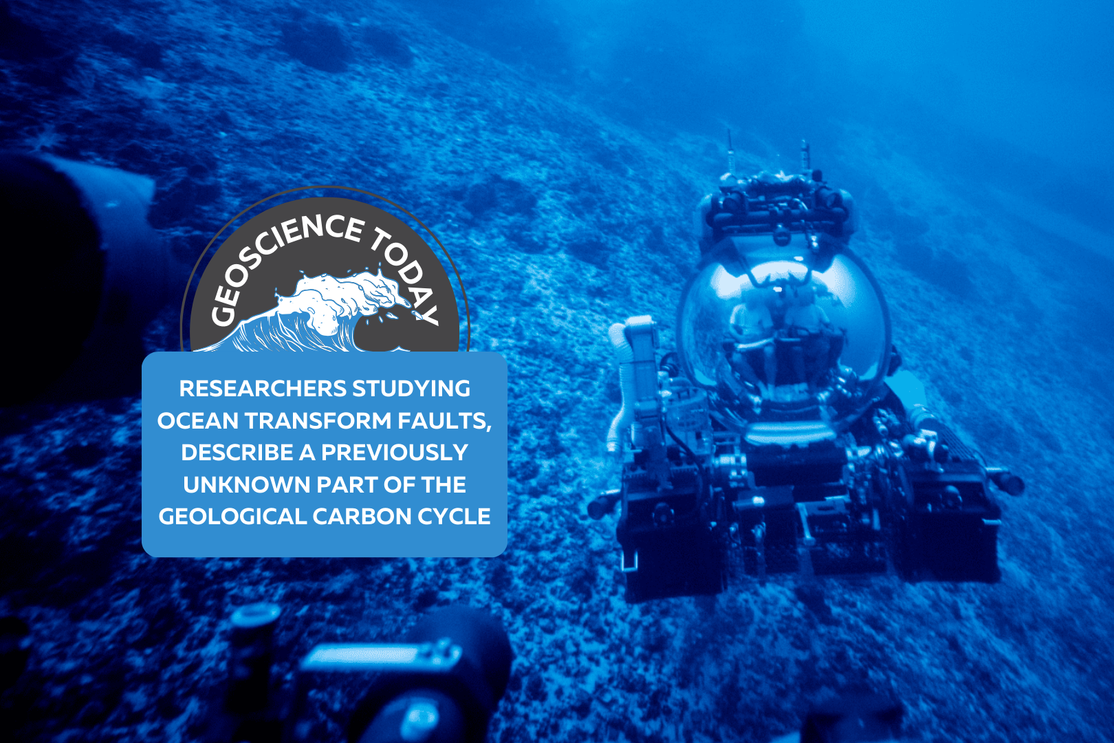
Submarine in the ocean. Text reads: "Geoscience Today: Researchers Studying Ocean Transform Faults, Describe a Previously Unknown Part of the Geological Carbon Cycle"

Researchers Studying Ocean Transform Faults, Describe a Previously Unknown Part of the Geological Carbon Cycle

Chief Scientist Frieder Klein and Deep Rover Pilot Alan Scot exploring a submerged carbonate platform. (Photo by: Novus Select) Woods Hole, Mass. Republished with permission. Original article here. Studying a rock is like reading a book. The rock has a story to tell, says Frieder Klein, an associate scientist in the Marine Chemistry & Geochemistry Department at the Woods Hole Oceanographic Institution (WHOI). The rocks that Klein and his colleagues analyzed from the submerged flanks of the St. Peter and St. Paul Archipelago in the St. Paul’s oceanic transform fault, about 500 km off the coast of Brazil, tells a fascinating and previously unknown story about parts of the geological carbon cycle. Transform faults, where tectonic plates move past each other, are one of three main plate boundaries on Earth and about 48,000 km in length globally, with the others being the global mid-ocean ridge system (about 65,000 km) and subduction zones (about 55,000 km). Carbon cycling at mid-ocean ridges and subduction zones has been studied for decades. In contrast, scientists have paid relatively scant attention to CO2 in oceanic transform faults. The transform faults were considered “somewhat boring” places for quite some time because of the low magmatic activity there, says Klein. “What we have now pieced together is that the mantle rocks that are exposed along these ocean transform faults represent a potentially vast sink for CO2,” he says. Partial melting of the mantle releases CO2 that becomes entrained in hydrothermal fluid, reacts with the mantle closer to the seafloor, and is captured there. This is a part of the geological carbon cycle that was not known before,” says Klein, lead author of a new journal study “Mineral Carbonation of Peridotite Fueled by Magmatic Degassing and Melt Impregnation in an Oceanic Transform Fault,” published in the Proceedings of the National Academy of Sciences (PNAS). Because transform faults have not been accounted for in previous estimates of global geological CO2 fluxes, the mass transfer of magmatic CO2 to the altered oceanic mantle and seawater may be larger than previously thought.” ”The amount of CO2 emitted at the transform faults is negligible compared to the amount of anthropogenic – or human driven – CO2,” says Klein. “However, on geological timescales and before humans emitted so much CO2, geological emissions from Earth’s mantle – including from transform faults – were a major driving force of Earth’s climate.” As the paper states, “global anthropogenic CO2 emissions are estimated to be on the order of 36 gigatons (Gt) per year, dwarfing estimates of average geological emissions (0.26 Gt per year) to the atmosphere and hydrosphere. Yet, over geological timescales, emissions of CO2 sourced from Earth’s mantle have been pivotal in regulating Earth’s climate and habitability, as well as the C [carbon]-concentration in surface reservoirs, including the oceans, atmosphere, and lithosphere.” Klein adds that “this is before anthropogenic combustion of fossil fuels, of course” “In order to fully understand modern human-caused climate change, we need to understand natural climate fluctuations in Earth’s deep past, which are tied to perturbations in Earth’s natural carbon cycle. Our work provides insights into long-timescale fluxes of carbon between Earth’s mantle and the ocean/atmosphere system,” says co-author Tim Schroeder, member of the faculty at Bennington College, Vermont. “Large changes in such carbon fluxes over millions of years have caused Earth’s climate to be much warmer or colder than it is today.” To better understand carbon cycling between Earth’s mantle and the ocean, Klein, Schroeder, and colleagues studied the formation of soapstone “and other magnesite-bearing assemblages during mineral carbonation of mantle peridotite” in the St. Paul’s transform fault, the paper notes. “Fueled by magmatism in or below the root zone of the transform fault and subsequent degassing, the fault constitutes a conduit for CO2-rich hydrothermal fluids, while carbonation of peridotite represents a potentially vast sink for the emitted CO2.” The researchers argue in the paper that “the combination of low extents of melting, which generates melts enriched in incompatible elements, volatiles and particularly CO2, and the presence of peridotite at oceanic transform faults creates conditions conducive to extensive mineral carbonation.” The rocks were collected using human-occupied vehicles during a 2017 cruise to the area. Finding and analyzing these rocks “was a dream come true. We had predicted the presence of carbonate-altered oceanic mantle rocks 12 years ago, but we couldn’t find them anywhere,” says Klein. “We went to the archipelago to explore for low-temperature hydrothermal activity, and we failed miserably in finding any such activity there. It was unbelievable that we were able to find these rocks in a transform fault, because we found them basically by chance while looking for something else.” Funding for this research was provided by the Dalio Ocean Initiative, the Independent Research & Development Program at WHOI, and the National Science Foundation. Authors: Frieder Klein*, Timothy Schroeder, Cédric M. John, Simon Davis3, Susan E. Humphris1, Jeffrey S. Seewald1, Susanna Sichel, Wolfgang Bach, and Daniele Brunelli,1 Affiliations: *Corresponding author About Woods Hole Oceanographic Institution: The Woods Hole Oceanographic Institution (WHOI) is a private, non-profit organization on Cape Cod, Massachusetts, dedicated to marine research, engineering, and higher education. Established in 1930, its primary mission is to understand the ocean and its interaction with the Earth as a whole, and to communicate an understanding of the ocean’s role in the changing global environment. WHOI’s pioneering discoveries stem from an ideal combination of science and engineering—one that has made it one of the most trusted and technically advanced leaders in basic and applied ocean research and exploration anywhere. WHOI is known for its multidisciplinary approach, superior ship operations, and unparalleled deep-sea robotics capabilities. We play a leading role in ocean observation and operate the most extensive suite of data-gathering platforms in the world. Top scientists, engineers, and students collaborate on more than 800 concurrent projects worldwide—both above and below the waves—pushing the boundaries of knowledge and possibility. For more information, please visit www.whoi.edu

Read More »
A desk with a keyboard, headphones, video game controller, toy and candy on it. On top of the photo text reads: Geoscience Today: Geoscience and Video Games.

Geoscience and Video Games

What do geoscience and video games have in common? More than you might think. Geoscience is key to understanding our world and addressing environmental crises. Despite this, geoscience programs continue to see a decline in numbers, and getting youth excited by and interested in geoscience is vital to the continuation of the field.  In Canada, youth spend an average of 7.9 hours per week playing video games. Video games are designed to entertain and often provide immediate rewards. In her 2010 TedTalk “Gaming can make a better world,” Jane McGonigal argues that self-learning from video games is just as important as formal education. By the time the average person in a country with a strong gaming culture turns 21, they will have spent 10,000 hours playing video games (Carnegie Mellon University). That same youth will have spent 10,080 hours in school from grade 5-12. “We have an entire parallel track of education going on, where young people are learning as much about what it takes to be a good gamer as they’re learning about everything else,” Jane states.  When gaming, youth are developing skills, adapting to changing environments, problem solving, and taking in new information. Judy Willis (2007) states that, “when students are engaged and motivated and feel minimal stress, information flows freely through the affective filter in the amygdala and they achieve higher levels of cognition, make connections, and experience “aha” moments. Such learning comes not from quiet classrooms and directed lectures, but from classrooms with an atmosphere of exuberant discovery.” I would argue that this theory applies not just in the classroom, but in informal settings including while youth are playing video games. Research shows that there are two main types of self-learning: tangential learning and incidental learning. Tangential learning is when someone consciously educates themselves on a topic they have been exposed to and in which they have interest. Incidental learning is less conscious and occurs through engaging in activities and tasks that promote learning. Video games are good at both of these types of self-learning. So, youth are learning from video games, but what exactly are they learning? There are two main types of video games: educational and entertainment. Educational, also called serious, games are designed with education as a priority. Often, these types of games sacrifice entertainment and end up being somewhat less engaging than off-the-shelf games. Popular off-the-shelf games usually use larger-than-life experiences or fantastical and magical environments to entertain players. As far as science communication is concerned, both educational and entertainment-focused games have the potential to teach science. However, it has been found that youth playing educational games tend to get bored easily and lose focus, which undermines some of their effectiveness (E. G. McGowan and J. P. Scarlett, 2021).  McGowan and Scarlett (2021) looked at the representation of volcanoes in off-the-shelf, or entertainment-focused, video games. They analyzed 11 of the most popular video games that contain elements of volcanism. They looked at what types of volcanic hazards were represented and whether or not they were scientifically accurate.  They chose to study volcanoes because they are a common geological phenomena that are often used in video games either as part of the background landscape or to provide a dangerous challenge. Volcanoes in real life can of course produce fascinating and beautiful landscapes as well as deadly effects such as lava flows, toxic ash fall, volcanic gases, lahars, pyroclastic flows, lava bombs, and more. This makes volcanoes a good challenge for players and is why they are often included in video games. The researchers wanted to find out if volcanoes were being portrayed with scientific accuracy. They found that the video games studied all had both accurate and inaccurate features of volcanoes, with no single video game being completely inaccurate or completely accurate. This means that any video game will have some aspect that correctly represents volcanoes, and so can inform gamers via incidental or tangential learning. It also means that any video game will have some aspect that may mislead or incorrectly teach people who play them. However, since most of these inaccuracies are used for the purpose of dramatization, it’s not necessarily the case that people are mis-learning from them. After all, people are capable of distinguishing video game landscapes from real ones.  A study by Hut et al. (2019) compared how well geoscientists and non-geoscientists could determine which landscapes in a video game were accurate to reality. They found that while geoscientists could more accurately determine false from real landscapes, non-geoscientists were also able to determine the difference fairly well. They concluded that despite the minor difference, video games can still be used for tangential learning on geoscience subjects.  McGowan and Scarlett (2021) concluded that video games could be used for outreach purposes in order to spark interest and get people invested in geological phenomena that they might not otherwise be interested in. This can lead to incidental and tangential learning, since video games are engaging and exciting. Once people are interested in a topic, they are more likely to seek out more information themselves and put effort into learning, so this can lead to more geoscience education. We can use video games for geoscience education, but we also need gamers for the field of geoscience. In her TedTalk, Jane McGonigal argues that gamers are learning four things while playing video games: urgent optimism, social fabric, blissful productivity, and epic meaning. Firstly, urgent optimism is the ability to act immediately to achieve a goal, with the belief that it is possible to complete. Secondly, gamers weave a tight social fabric through collaboration and competition with others. Next, gamers are experiencing blissful productivity. Video gaming is often associated negatively with laziness or lack of motivation, when in reality, gaming is productive work. It’s work that often feels more immediately rewarding than real-life work due to instant in-game rewards. Finally, epic meaning is the belief you are completing something meaningful and awe-inspiring, even if just to a fictional world.  Chris Skinner (2021),

Read More »
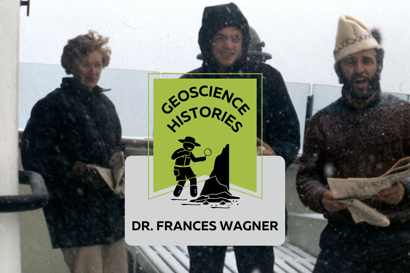
Three people standing on the deck of a boat with snow falling. Text on top of the photo reads: "Geoscience Histories, Frances Wagner"

Geoscience Histories: Dr. Frances Wagner

Frances Wagner was one of Canada’s first female geologists. Her studies in micropaleontology and mapping of Canada’s microscopic fossils were groundbreaking to our understanding of the geology of the continental shelves around Canada, especially the Arctic.  Frances was born in May of 1927 and grew up in Hamilton, Ontario, spending summers enjoying nature at her family’s cottage on Mary Lake. She and her brother would identify the lichens on the Canadian Shield rocks and go canoeing and exploring.  Wagner studied paleontology at the University of Toronto for her undergrad and went on to complete a Master’s degree in invertebrate paleontology at UofT. She researched Ordovician fossils near Ottawa under Dr. Alice Wilson (see our blog post on Dr. Wilson). The summer before she completed her Master’s degree she was hired by the Geological Survey of Canada (GSC) to catalogue fossil samples from the Victoria Museum in Ottawa. She was only the third woman to work at the GSC, in a time where women were considered too weak to do field work. Frances Wagner and her colleague Dr. Helen Belyea were some of the first women to work in the field at the GSC in the summer of 1950 with the support of Dr. Alice Wilson. Wagner went on to complete her PhD in micropaleontology at Stanford University in California. Her thesis was supervised by another groundbreaking female geoscientist Dr. Myra Keen. Her thesis was on marine Pleistocene deposits in southwestern British Columbia. She studied with a Geological Survey of Canada work party on the coast of British Columbia and shipped 350 pounds of samples from British Columbia to California to complete her studies. Her PhD allowed her to pioneer the study of marine micropaleontology. In 1954 Wagner returned to Ottawa to work full time at the GSC and complete her thesis at the same time. In order to complete her PhD she travelled three days by train to Stanford and three days back for her oral exam. In 1964, Wagner’s colleague Charlotte Keen was the first woman to travel on a research ship. The next summer, Dr. Wagner joined Keen and a few other women on the CSS Hudson to map the floor of Hudson’s Bay. The CSS Hudson was the first ship to circumnavigate North America. Wagner joined the ship as it traversed the dangerous Northwest Passage. This was a particularly perlious journey, and they concluded that the Northwest Passage was unsafe for travel. Chief Scientist Dr. Bernard Pelletier wrote in the ship report that at one point, “[the ship] rode up onto a particularly hard floe and slid off one side thereby heeling to port so abruptly and steeply that her guardrail almost touched the broken sea ice.” This is just a taste of the danger that Dr. Pelletier wrote in the report. While on the CSS Hudson, Dr. Wagner studied the ecological history of the Beaufort Sea and published groundbreaking work on the topic. In 1967, Dr. Wagner moved to Nova Scotia to work for the Bedford Institute of Oceanography. She used her experience in marine micropaleontology to study the microbiota of the Arctic and Atlantic continental shelves. In 1973 Dr. Wagner was elected as a Fellow of the Royal Canadian Geographical Society. In 1979 she co-authored a second paper on the Beaufort Shelf, this one focusing on the effects of disturbances, such as hydrocarbon drilling, on the marine ecology of the area. Outside of her career, Frances was an avid horsewoman. She owned two registered Morgan horses, Belle and Jay. She raised Jay from 5 months old and rode him for 24 years. She helped found the Nova Scotia Historical Riding Society and learned to ride sidesaddle in order to do demonstrations of traditional riding techniques at different Museum sites in Nova Scotia. She also researched and sewed traditional clothing for the Uniacke Heritage Society. Wagner was also a dog breeder. She had a kennel called Thicketwood where she bred Shetland Sheepdogs. She helped save the rare Norwegian Lundehund from extinction, importing them to Canada and breeding and showing them. Once she retired in 1984, she focused more of her time and attention on her dog breeding and horseback riding. She always had a love for the outdoors, and was an accomplished canoeist and long distance swimmer.  Wagner never married or had kids. When asked about it she said, “I was a career girl.” In Wagner’s day there was a lot of prejudice against women in the workplace getting married or having families. In Canada there was a law in place that allowed employers to fire female employees if they married. This legislation was only repealed in 1955, when Wagner was already 28 years old. Dr. Wagner had an immense influence on the field of micropaleontology in Canada. You can read one of Dr. Wagner’s publications, “Fossils of Ontario: Part 2: Macroinvertebrates and vertebrates of the Champlain Sea,” published by the Royal Ontario museum. Along with her female colleagues, she defied expectations and made major contributions to her field doing work that was previously considered improper or too difficult for women. Sources:  Science.ca Scientist Profile Frances Wagner Trowelblazers Frances Wagner NecroCanada Obituaries Frances Wagner Ada Lovelace Day Dr Frances Wagner Paleontology and stratigraphy of the marine Pleistocene deposits of Southwestern British Columbia. Fossils of Ontario: Part 2: Macroinvertebrates and vertebrates of the Champlain Sea Author Veronica Klassen is the Manager of the Foundation’s blog – Beneath Your Feet: A Geoscience Blog. She studied Arts and Science at McMaster University with a minor in Earth Science and has a masters in Science Communication from Laurentian University. She is passionate about making science accessible and engaging to the public.

Read More »